Remote elevation – Spectra Precision Survey Pro v3.80 Ranger GPS User Manual User Manual
Page 32
GPS User’s Manual
28
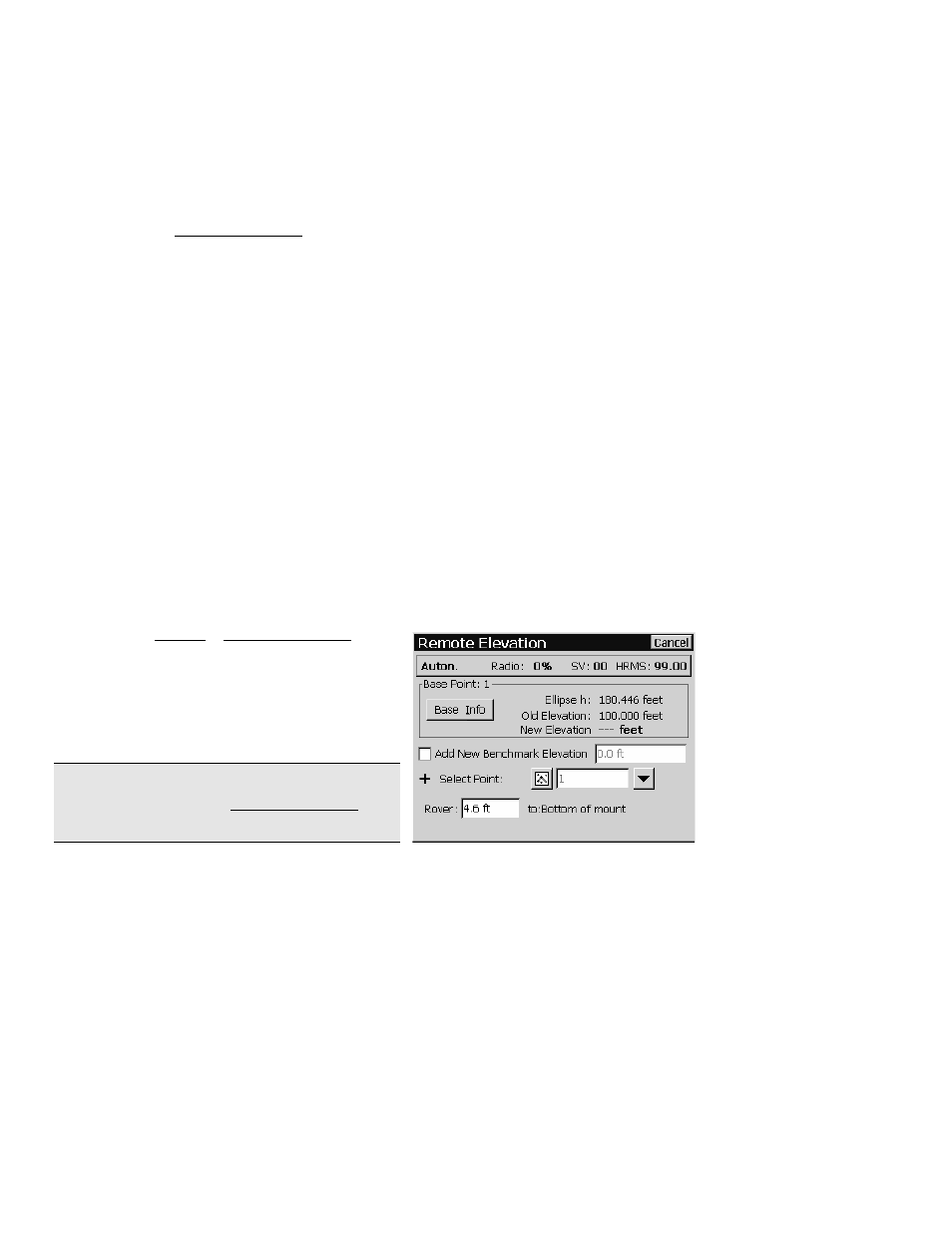
Remote Elevation
If you set your base on a known benchmark, you can begin collecting
data right away. However, if your base station is on a new point, then
you should calculate the elevation of the base and create or update a
vertical site before collecting new data.
You can use the Remote Elevation routine to occupy a vertical
benchmark with the rover. Applying the results of the occupation
will update the base point elevation and create a new one-point
vertical localization without entering the localization routine. The
horizontal localization will remain unchanged.
The following conditions must be met in order to use the Remote
Elevation routine.
•
The base and rover must be set and the rover cannot be in
manual entry mode.
•
Geoid modeling must be selected with a geoid model selected.
•
Mapping plane mode; projection must be set.
•
Ground – TDS Localization mode; horizontal localization
must be set.
•
If the base is autonomous the horizontal localization must be
solved. If not, you can still use the routine as the “Occupy
Vertical Control Point” routine. Updating the selected vertical
control point will not affect the base height or vertical
localization parameters.
1.
Open the Survey | Remote Elevation
screen.
2.
If your benchmark is not in the job file,
select the
Add Benchmark
checkbox, enter
the
Elevation
, and specify a new point
number in the
New Point
field.
Note: You cannot enter a new elevation for an
existing point using the Remote Elevation
routine.