Mercedes-Benz CL-Class 2008 Owners Manual User Manual
Page 196
195
Control systems
COMAND navigation (introduction)
Current street
You can set whether the current street you
are driving on should be displayed in the
map.
̈
Displaying: Select “Navi”
Ǟ “Navi” Ǟ
“Map Display”.
The map display list appears. A dot
R
indicates the current setting.
̈
Select “Current Street”.
Depending on the previous status the
display showing the current street is
switched on or off.
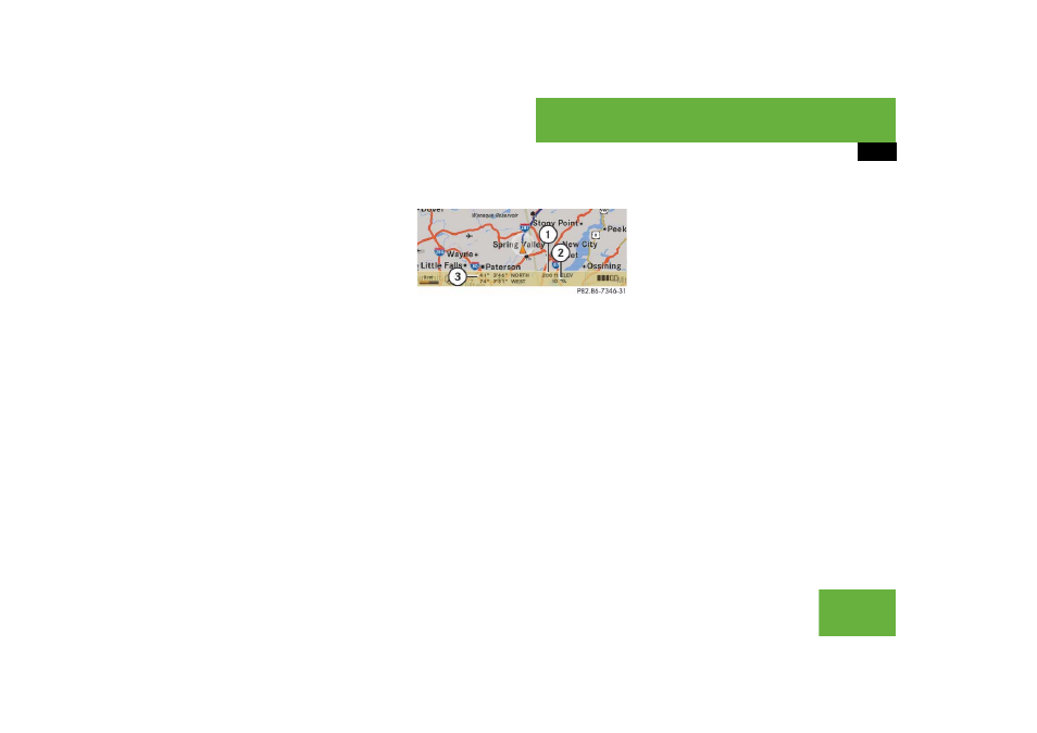
Geo-coordinate display
Illustration: map with geo-coordinate dis-
play switched on
1 Current height above sea level
2 Number of GPS satellites from which
signals for positioning can be received
3 Coordinate display
Display options with geo-coordinate dis-
play switched on
If the crosshair is displayed on the map
view (map was moved manually), only dis-
play
3 is visible.
It shows either the coordinates of the
crosshair or other data on the crosshair
position, e.g. a street name. The digital
map must contain relevant data in order
for this other data to be displayed.
i
There must be sufficient GPS reception for
displays
1, 2 and 3 to be shown. Height dis-
play
1 is an approximation because the naviga-
tion system uses the GPS signals for the
calculation.
i
If there is no crosshair on the map view, dis-
plays
1, 2 and 3 are visible. Display 3
shows the coordinates of the current vehicle po-
sition.