Viewing distance calculations, Determining distance with the offset indicator – Jeppesen FliteDeck Pro 8 (Windows 8.1) User Manual
Page 27
Enroute View
Viewing Distance Calculations
Jeppesen FliteDeck Pro User Guide
August 2014
Copyright © 2014 Jeppesen. All rights reserved.
22
Viewing Distance Calculations
The distance-measuring tool is a set of rings or arcs that provide
constant awareness of the relative distance between features on
the map at a glance. These rings are called range rings. As you
zoom in or out of the map, the range rings change with the map
scale.
To show and hide range rings:
• Tap the Range Rings button.
The center-most ring includes a compass rose that indicates true
north, south, east, and west. The center is called the reference
point. Tic marks are drawn at 15-degree intervals between the
cardinal points of the compass.
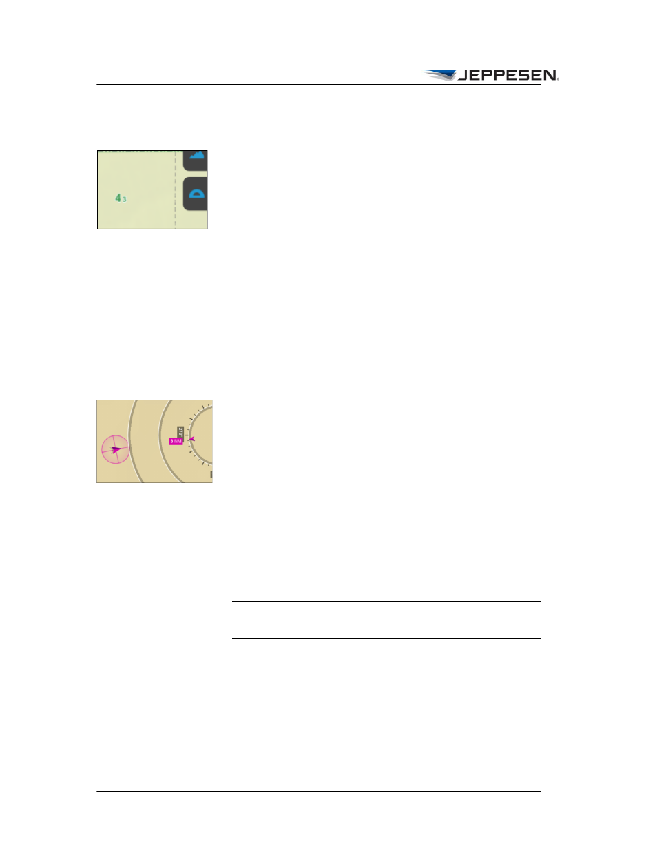
Determining Distance with the Offset Indicator
When you display range rings, a distance indicator appears if the
ownship is outside of the centermost ring. The indicator indicates
the exact distance from the center of the ring to the ownship
symbol.
To determine the distance and direction from your aircraft to any
other object on the map:
1. Tap the Range Rings button to show the range rings.
2. Pan the map so that the map object in question is in the
center of the inner range ring.
A magenta offset indicator appears, showing distance and
direction to your aircraft position.
NOTE If you toggle range rings off, the offset indicator no
longer appears.