Draw polygon – 3D Robotics X8-M User Manual
Page 11
10
2
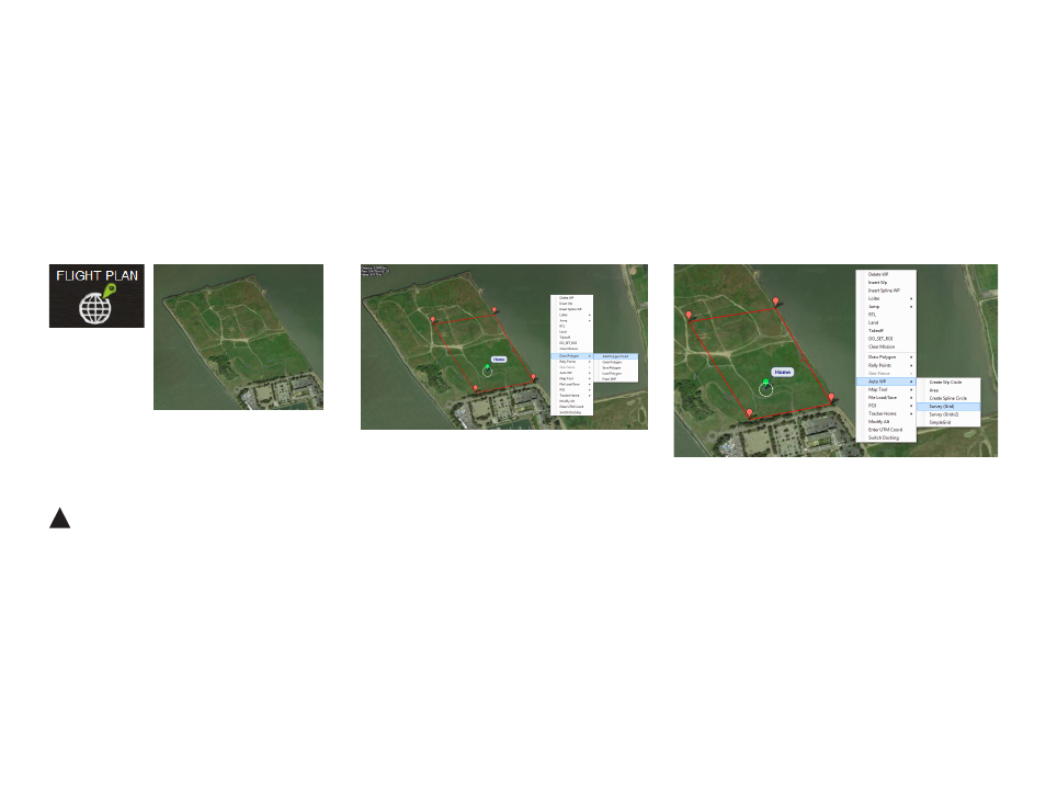
Right click on the map. Select Draw Polygon and
Add Polygon Point. Click and drag to add points
around the area you want to map.
3
Right click on the polygon. Select Auto WP and
Survey (Grid) to open the Survey Tool.
Units
The Survey Tool uses metric units. If your Mission Planner is
set to imperial units, please change the settings to use metric
to plan the mission. Support for imperial units in Mission
Planner is coming soon; check 3DR.com/X8-M for updates.
Draw Polygon
To begin planning the mapping mission, select the area you want to map using
the Polygon tool. You’ll be able to adjust the size and shape of the polygon later in
the mission configuration process.
1
Select Flight Plan, and zoom to your
mapping location.
Mission Planner Flight Plan tab: zoom to mapping location
Mission Planner Flight Plan tab: draw polygon
Mission Planner Flight Plan tab: open Survey tool
!