2 heading marker, 3 degree scale – Seiwa SWRx series User Manual
Page 23
25
User Manual
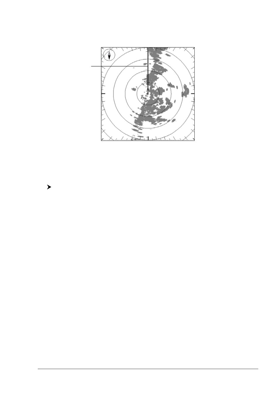
2.3.2 Heading Marker
The Heading Marker (HM) is the line from the own vessel’s position to the edge of
the picture at the vessel’s current heading with respect to the North indicated by
the compass.
Heading Marker (HM)
Fig. 2.3.2- The Heading Marker
The Heading Marker is updated each time the Radar image is updated. It can
temporarily be hidden to check for small targets under it by positioning the Cross
Cursor over it and pressing [CLEAR].
To enable (On) or disable (Off) the display of the Heading Marker follow this
procedure:
[MENU] + "Radar Features" + [ENTER] + "Heading Marker" + [ENTER] +
"On"/"Off" + [ENTER]
2.3.2.1
Handling of Heading Marker
Positioning the Cross Cursor on the Heading Marker activates a pop up message
"HM" underneath the cursor. It is possible to select the Radar orientation among
Head Up (HU), North Up (NU) or Track Up (TU) using the following software/
function keys. See also the Par. 2.1.4.
♦
[Head Up]
1
: The Radar picture is displayed with the vessel’s current
heading upwards. As the heading changes the picture will rotate.
NOTE
1
F
OR
SEAWAVE
3
, press [2, Head Up].
♦
[North Up]
1
: The Radar picture is stabilized and displayed with north
upwards. As heading changes, the ship’s Heading Marker moves.
NOTE
1
F
OR
SEAWAVE
3
, press [3, North Up].
♦
[Track Up]
1
: The Radar picture is stabilized and displayed with the
currently selected Course Leg upwards. As heading changes, the ship’s
Heading Marker moves.
NOTE
1
F
OR
SEAWAVE
3
, press [4, Track Up].
♦
[Off]
1
: disables the Heading Marker.
NOTE
1
F
OR
SEAWAVE
3
, press [1, Off].
2.3.3 Degree Scale
The Degree Scale is the graduated scale located on the most external visible
range ring edge of the Radar page, with major ticks at 0, 10, 20, …, 350 degrees
and minor ticks at 5, 15, 25, …, 355 degrees.