3d moving map – Telenav for Verizon Supported Devices: v5.5 for BlackBerry Storm User Manual
Page 32
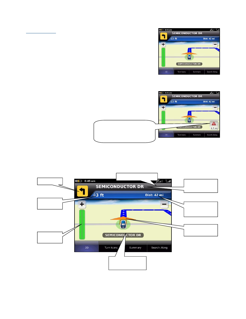
3D Moving Map
A 3-dimensional map with turn icons (default).
This view allows you to see how the road ahead is organized, similar to the
perspective of a bird flying above the route. You can see the route to your
destination as a blue overlay on one of the roads with white triangles
leading you in the correct direction. Orange arrows mark any upcoming
turns.
The name of the street you are currently on is displayed at the bottom of the
screen. About two minutes before the next turn, the street name changes to
the one you will turn onto.
When you are viewing moving maps during navigation and have set Traffic
Alerts to “On” in Share & More >> Preferences, a Traffic Alert icon will
appear at the left of the map if there is an accident less than 15 miles ahead
of your current route. You will see the distance along the route until the
accident and hear an audio warning.
(Audio)
“Accident 5.7 miles ahead on US
101 at Lawrence Expressway; 1
lane closed. Tap to avoid.”
The content on the 3D Moving Map navigation view is explained below.
GPS signal strength
Name of the street
you will turn onto
Next turn
Distance and
estimated time
remaining
Distance
traveled
Directional
heading
Name of the street
you are on
Progress
indicator
© TELENAV, INC. 2003-2010
PAGE 32 OF 64