Alarms on maps – Milestone XProtect Smart Client 2013 User Manual
Page 153
Milestone XProtect
®
Smart Client
2014
User's Manual
www.milestonesys.com
153
Events and alarms
Tip: In fields where you type your filtering criteria, typing the first few characters of the required name,
location or similar is often enough.
Having entered filtering criteria, note that the alarm list will not be updated until you move the insertion
point to another filter field.
Tip: If your alarm handling views contain map content, you can also filter the alarm list by right-clicking
an element (camera, server, or similar) on the map, then selecting Show Alarms. This will make the
alarm list show only alarms from the selected element.
To sort the alarm list's content, in the Alarm list, click the
button at the top of the column.
Alarms on maps
If your alarm handling view contains one or more map (see "Maps" on page 67) positions, you can
view alarms on the maps too. Maps display alarms based on the geographical location of the camera,
server or other device triggering the alarms, so you can instantly see where the alarm originates from.
You can right-click and acknowledge, disable, or suppress the alarm directly from the map.
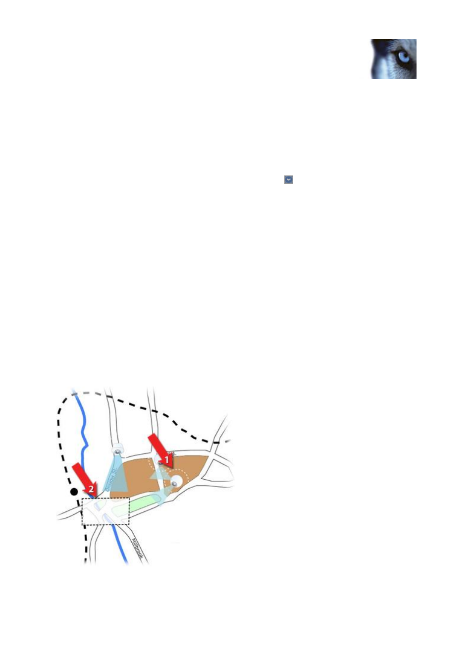
Camera elements display video in thumbnail format when you move your mouse over it. When used
together with alarms, the graphical elements on maps display white circles around them if alarms
occur. For example, if an alarm associated with a particular camera occurs, the graphical element
representing that camera will immediately get a white circle around it (1 in the following illustration),
and you can then click the camera element and not only view video from the camera, but also handle
the alarm through a menu that appears.
Tip: If white is not an ideal color for signifying alarms on your maps, you can change this color.
Now, say the camera which has an alarm associated with it, is located on a street level map, but you
are viewing a city level map. How will you then notice the alarm? No problem, thanks to hot zones
—
graphical representations linking different map hierarchy levels together. If an alarm is detected on the
street level map, the hot zone on the city level map will then turn white (2 in the following illustration),
indicating that there is an alarm on a lower level map
—even if there are map levels in between.
To return to an alarm list mode where you can see alarms from more than just the one element, click
the required server, priority or state in the alarm list.