To view weather data at a specific location, Place the cursor in the required location, Animating weather graphics – Raymarine SR100 User Manual
Page 39: Surface pressure, Viewing weather data at a specific location
36
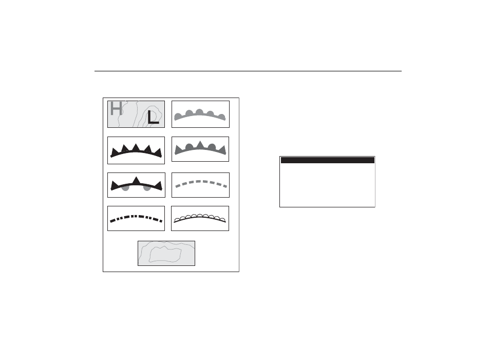
Surface pressure
Surface pressure can be shown using standard meteorological symbols:
Viewing weather data at a specific location
You can show the following details for a particular location regardless of
the product Show/Hide status
• Sea temperature.
• Wind speed and direction.
• Wave height.
• Precipitation type and intensity.
To view weather data at a specific location:
1. Place the cursor in the required location.
2. Press OK. The Weather information dialog box appears.
The dialog box also contains a description of the marine zone selected by
the cursor’s position.
Animating weather graphics
Using the animated weather option you can view an animation from the
current time for:
Squall line (red)
1012
High (blue) Low pressure (red)
Cold front (blue)
Warm front (red)
Occluded front (purple)
Stationary front (blue-red)
Trough (brown)
Isobars (grey)
1010
Dry line (red)
Zone desription
North Altantic Ocean between 31N and 67N latitude and
between the East Coast North America and 35W lonitude
Zone ID
Precipitation Intensity
Precipitation Type
Sea Surface temperature
Wind Speed
Wind Direction
Wave Height
XXX
<5dBz
None
-.-oF
20.0kt
255
o
T (WSW)
-.-ft
Weather Info