Tropical storm data, To display tropical storm data, Press ok. the tropical storm data box appears – Raymarine SR100 User Manual
Page 35: Storm track
32
Storm track
You can use the STORM TRACK function to monitor significant storms in an
area. These include:
• Tropical disturbances.
• Depressions.
• Storms and cyclones.
• Hurricanes.
• Typhoons and super typhoons.
The weather application shows:
• the track the storm has taken.
• its current and forecasted positions.
• the wind radii (current position only).
• wind direction.
• speed of travel.
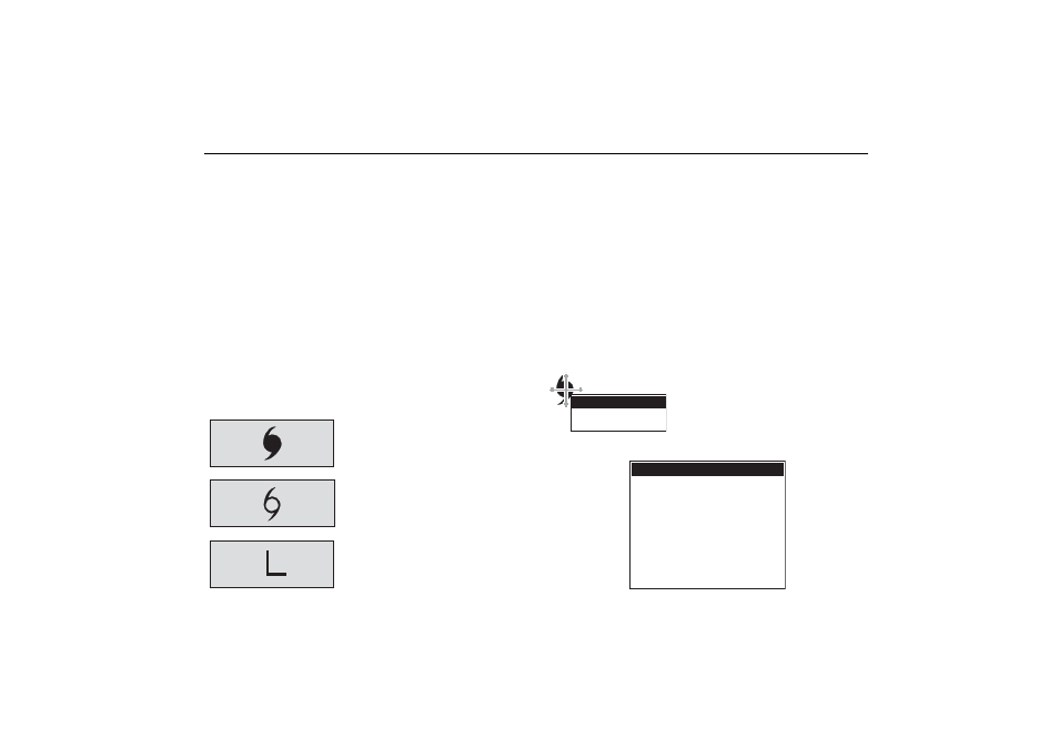
There are 3 symbols used to represent storms:
Each of these symbols can be displayed on screen in 3 different colors to
show its status:
• Grey historical,
• Red current.
• Orange forecast.
Tropical storm data
You can display tropical storm data for a selected storm. This data includes:
• Storm’s name and type.
• Date and time.
• Position, direction and speed.
• Pressure and maximum wind speed and gusts.
To display tropical storm data:
1.Place the cursor over the storm symbol.
The Object Information dialog box appears
giving details of the storm type.
2.Press OK. The Tropical Storm Data box
appears.
Hurricane
Category 1 5
Tropical storm
Tropical Depression
Hurricane Category 2
OK for more info
OBJECT INFO
Storm name
Storm ID
Storm Type
Direction
Speed
Max Wind Speed
Max gust Speed
Pressure
Date
Time
Position
Tropical Storm Data
EPSILON
AL292005
Hurricane Category 2
075oT
9.9kt
64.9kt
80.1kt
987mb
12/03/2005
3:00PM
34
o
30'.000N/044
o
24'.000W