Atlantic ocean region east, See map in appendix h, Worldphone may communicate – Magellan GLOBAL SATELLITE TELEPHONE User Manual
Page 154: Pacific ocean region, Appendix h – system description cont’d, System satellites, System description cont’d, See figure, Figure 2 satellite positions, Worldphone – chapter 5. appendices h-2
WorldPhone – Chapter 5. Appendices
H-2
Appendix H – System description cont’d
System description cont’d
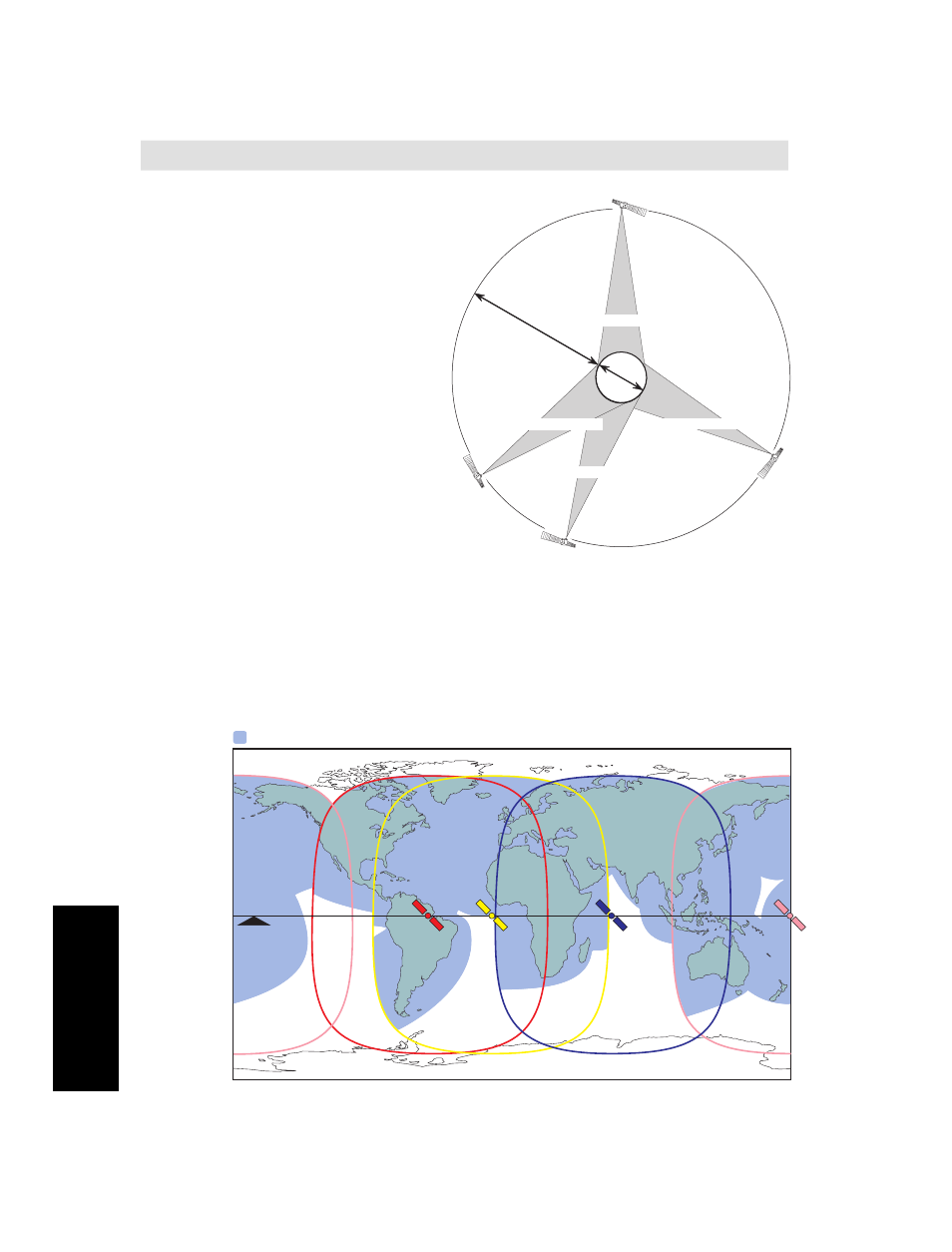
System satellites
The satellites are positioned
in a geostationary orbit
above the equator at
approximately
35700 km altitude.
See figure.
In geostationary orbit,
each satellite moves at
the same rate as the
earth, and so remains
in the same relative
position to the earth.
The satellites cover ap-
proximately 1/4 of the earth
each, called Ocean Regions:
AOR-W Atlantic Ocean West Region
AOR-E Atlantic Ocean East Region
IOR
Indian Ocean Region
POR
Pacific Ocean Region
The coverage area of the satellites for WorldPhone (Mini-M) is shown
on the map below.Communication is possible in areas marked with
grey.
EQUAT
O
R
EARTH
12000 km
35700 km
Pacific Ocean Region
Indian Ocean Region
54
°
W
64.5
°
E
178
°
E
15.5
°
W
Atlantic Ocean Region (West)
Atlantic Ocean Region (East)
Figure 2
Satellite positions
WorldPhone coverage
Equator
AOR-W
IOR
AOR-E
POR