Airmar WeatherCaster™ Software User Manual
Page 31
31
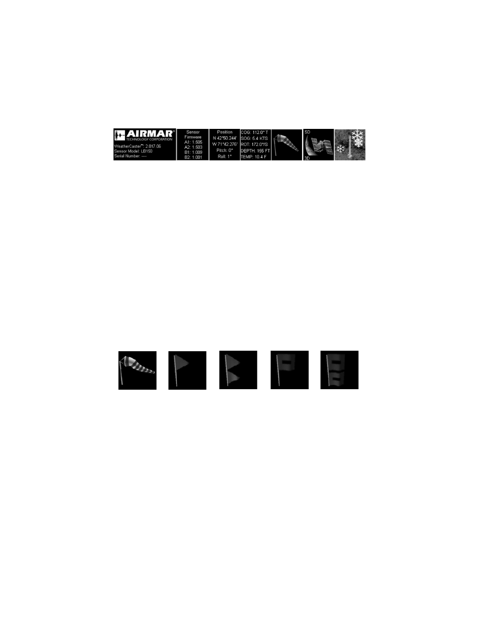
Data Boxes
There are seven data boxes at the top of each screen (see Figure 27).
1. This box displays the WeatherCaster software version number as well as the
model number and serial number/name of the sensor that is currently being
monitored.
2. This box displays the firmware version that is installed within the sensor itself.
3. This box displays the vehicle/vessel‘s current position on the globe in latitude
and longitude as determined using GPS. The average angle of pitch and the
average angle of roll is displayed digitally in degrees.
4. This box displays the vehicle/vessel’s speed over ground (SOG) and course
over ground (COG) which is calculated using GPS. If you have an Airmar Smart
Sensor connected through an optional Combiner, it will also display water depth
and water temperature.
5. This box displays the wind-speed icon that relates to the actual wind speed. The
icon will change as the wind speed increases or decreases. A wind sock
indicates a wind speed of 0 to 20 knots, while a flag indicates higher wind
(see Figure 28).
6. This icon indicates if the GPS inside the sensor has a satellite fix. When the
icon is flashing, there is no GPS fix. A stable icon (no flashing) indicates a fix.
• 2D indicates a 2D fix.
• 3D indicates a 3D fix.
• SD indicates the unit has a satellite differential fix, either WAAS or EGNOS.
7. This icon will appear only when the air temperature is below 0°C (32°F).
1.
2.
3.
4.
5.
6.
7.
Figure 27. Data boxes
15–20 knots
Small Craft
Gale Warning
Tropical Storm
Warning
Hurricane
Warning
Warning
Figure 28. Wind-speed icons