Airport information – Jeppesen Mobile FliteDeck for iPad User Manual
Page 38
Viewing Enroute Map Information
View Map Object Details
October 2014
Jeppesen Mobile FliteDeck User Guide
Copyright © 2014 Jeppesen. All rights reserved.
31
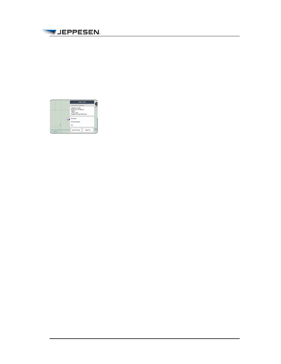
Airport Information
In addition to general airport information, the Airport popover
includes runway, communication, and access to weather
information.
To view airport information from the enroute map:
1. Touch, hold, and release the airport to display the airport
popover.
• Tap Runways to view the size and surface of runways at
the airport. Reciprocal airport runways are grouped together
with information organized by chart. Tap a specific runway
to view more information, such as displaced threshold,
lighting, and TDZ elevation.
• Tap Communication to view airport communication
information grouped by type. When more than two of a
given type are available, the first two are provided. To
display more frequencies, tap the More button.
• Tap Wx to view METAR/TAF information at that airport.
2. Tap away from the popover to dismiss it.
Note that airports are filtered by runway length in the Enroute
view and are automatically based on zoom scale. For example:
In High IFR theme:
• 160nm/in - IFR airports with Runways >10000 feet
• 80nm/in - IFR airports with Runways >8000 feet
• 40nm/in - IFR airports with Runways >5000 feet
• 5nm/in - All IFR airports
In Low IFR theme:
• 80nm/in - IFR airports with Runways >8000 feet
• 40nm/in - IFR airports with Runways >5000 feet
• 5nm/in - All IFR airports
• 2.5nm/in - All IFR and VFR airports