Telenav for Nextel Supported Devices: v4.0 for BlackBerry 7520 User Manual
Page 21
© TELEVIGATION 2003-5
PAGE 21 OF 32
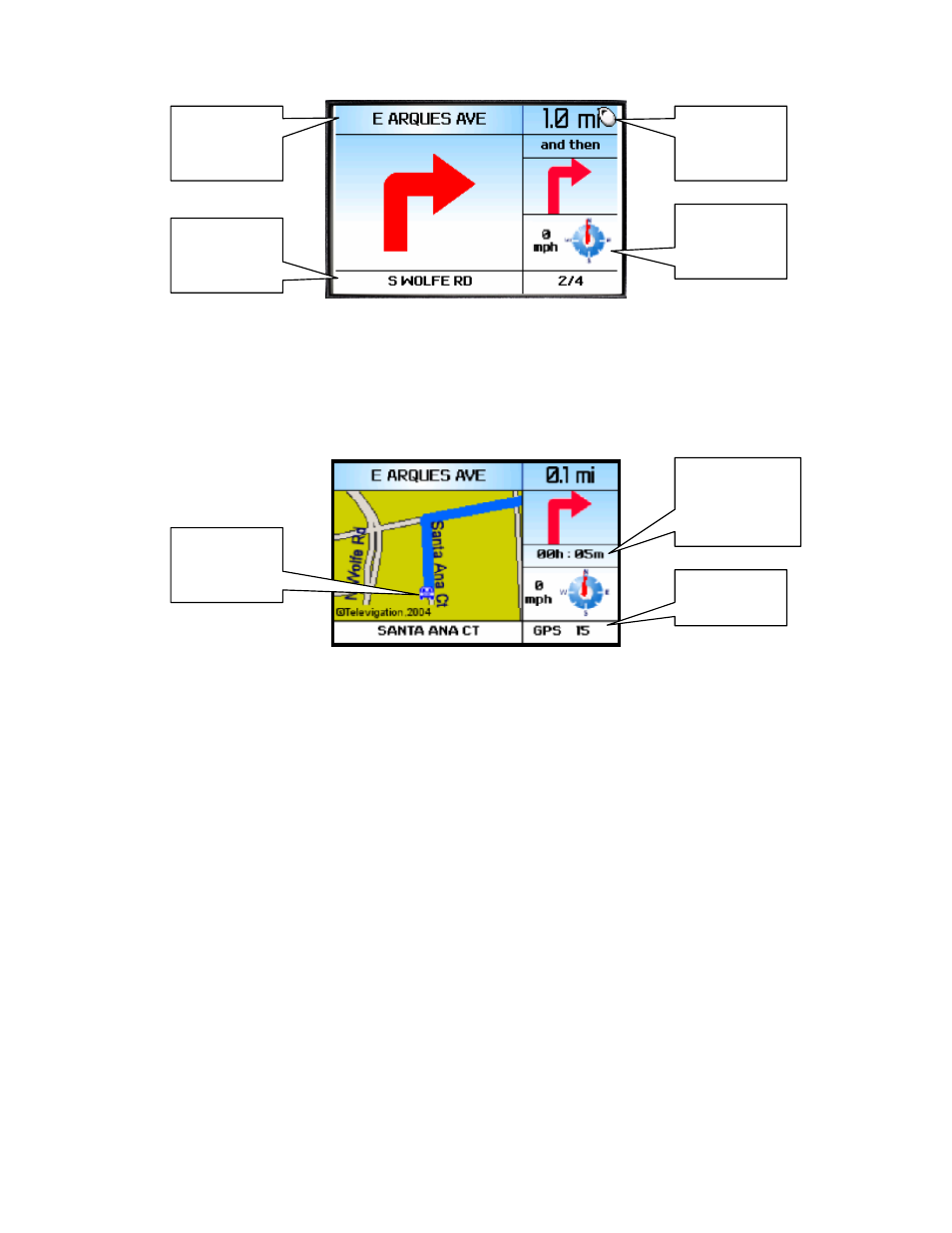
When the next turn along the route almost immediately follows the turn indicated by the main turn icon, a second
turn icon appears on the right side of the screen above.
With Intersection maps turned on in Preferences, you will also see a map of the route around the intersection. The
map is oriented so that the segment you are on will be drawn upward from the bottom of the screen so that you do
not have to deal with a confusing North-oriented view. The main turn icon is fitted on the right as shown below.
When the next turn along the route almost immediately follows the turn indicated by the main turn icon, a second
turn icon appears where the speed and heading information is shown above.
If you have the icon timing Preference set to “2 mins before next turn” and you will be traveling on the same
roadway for a mile or more, the Upcoming and Current Street names will be the name of the street you are on, and
the main or upper turn type icon will be a vertical arrow. As you approach the turn the icon will change to indicate
the type of turn you should make. As you move, the distance to turn and the remaining distance will decrease.
Eventually, you will see the destination arrival screen. This screen will show you how far it is to your destination
and whether it is on the left or right side of the street or road.
When you arrive at your destination, press the trackwheel , and return to TeleNav home menu.
Audible Messages
TeleNav delivers audible guidance messages as you drive. An informational message will be heard shortly after
making a turn, provided that there is time to deliver it and the preparatory message that follows. The preparatory
message will be heard no less than 30 seconds before reaching a turn, and the action message will be heard no
less than 10 seconds before reaching the turn. The preparatory message may not be heard if the distance to go
only allows time for the action message. The lead-time for these messages is increased proportionally to your
driving speed to allow more time for changing lanes on freeways than on surface streets. A Preference setting
determines whether street names are included in the messages, or not. Enabling street names increases packet
data usage.
Name of the
street you
are on
Name of the
street you will
turn onto
Distance to
the next turn
Speed and
direction of
travel
Distance
remaining, and
estimated time
to go
GPS error in
meters
Your current
location on
the map