Telenav for Nextel Supported Devices: v4.0 for BlackBerry 7520 User Manual
Page 18
© TELEVIGATION 2003-5
PAGE 18 OF 32
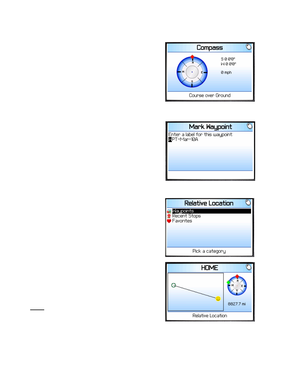
Compass
If you choose Compass, you will see a display similar to a nautical
compass. More correctly, it actually displays course over ground,
the direction you are traveling if you are moving. The screen also
provides current latitude, longitude, and speed. Using the main
menu Preferences, you can select the format of the speed as
miles per hour or kilometers per hour.
If no GPS data is available, “No GPS” appears instead of latitude
and longitude.
Press ESCape to return to the TeleNav Tools submenu.
Mark a waypoint
This menu option allows you to mark and label your current
location for future reference. If you choose Mark waypoint, there
will be brief activity to determine the GPS position, and then you
will need to enter a label or accept the default label that is based
on the current date.
After the waypoint is saved, you will be returned to the TeleNav
Tools menu.
Relative Location
Selecting Relative Location allows you to see the spatial
relationship of a selected remote point relative to your current
location. The remove points are in lists of: a) Recent Stops (an
address used for navigation, for example), b) Favorite Addresses
that you labeled and marked to be saved, or c) marked
Waypoints. Select the category, and then select a specific point
(see the Recent Stops list above as an example). The handheld
will try to get a GPS fix, and then display a plot showing your
relative location to the selected point.
The “Smiley Face” is your location, and the other end of the vector
is the selected point. The header text is a label derived from the
selected point information. The view is North oriented, and the
approximate distance to the selected point is shown. The green
diamond on the perimeter of the course over ground (compass)
indicator is the relative bearing from where you are to the selected
item. If you are going straight toward the location, the green
diamond will overlay the red diamond at the top of the indicator.
NOTE: The plot and distance will not be shown when there is no
GPS data.
TIP: When you park your car in an open lot, mark its location as a
waypoint. Later you can use Relative Location to assist you in
finding where you parked.