Altitude display, Hazard avoidance – Garmin G1000 Socata TBM 850 User Manual
Page 404
Garmin G1000 Pilot’s Guide for the Socata TBM 850
190-00709-01 Rev. A
392
HAZARD AVOIDANCE
SY
STEM
O
VER
VIEW
FLIGHT
INSTRUMENTS
EAS
AUDIO P
ANEL
& CNS
FLIGHT
MANA
GEMENT
HAZARD
AV
OID
ANCE
AFCS
ADDITIONAL FEA
TURES
APPENDICES
INDEX
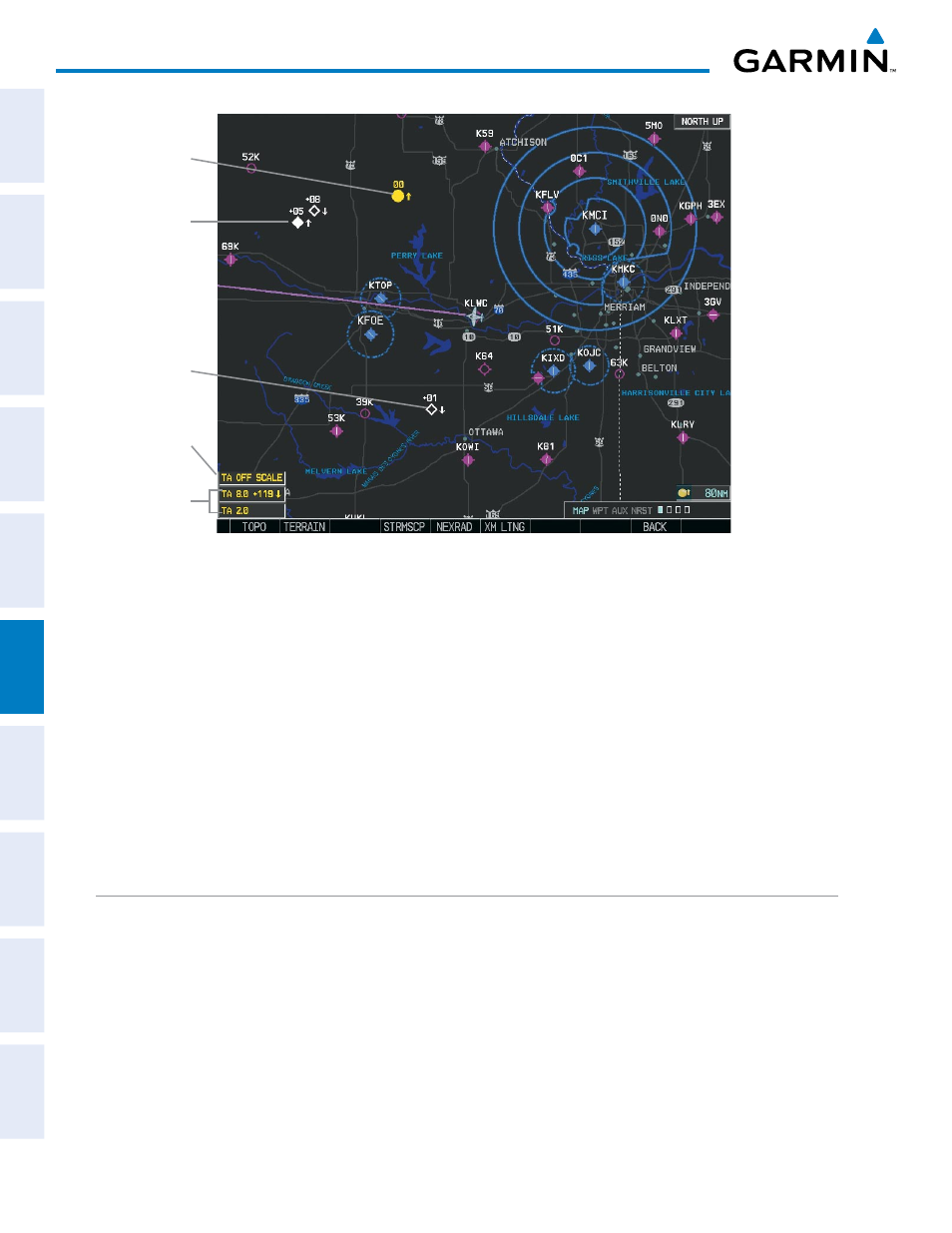
Proximity
Traffic
Figure 6-102 TAS Traffic on Navigation Map
Traffic
Advisory
TA Off Scale
Banner
Non-Bearing
Traffic Advisories
Non-Threat
Traffic
Displaying traffic information (PFD Inset Map):
1)
Press the INSET Softkey.
2)
Press the TRAFFIC Softkey to display traffic data on the inset map (TRFC-1).
3)
Press the softkey again to display the traffic-only inset (TRFC-2).
4)
Press the softkey again to remove traffic data.
The Navigation Map Page Setup Menu also controls the display of traffic. The setup menu controls the map
range settings. Traffic data symbols and labels can be decluttered from the display. If a map range larger than
the map range setting is selected, the data is removed from the map. Maps besides the Traffic Map Page use
settings based on those selected for the Navigation Map Page.
ALTITUDE DISPLAY
Changing the altitude display mode:
1)
On the Traffic Page, press the ALT MODE Softkey.
2)
Press one of the following Softkeys:
•
BELOW
•
NORMAL
•
ABOVE
•
UNREST (unrestricted)