Hazard avoidance, Displaying traffic data – Garmin G1000 Socata TBM 850 User Manual
Page 403
190-00709-01 Rev. A
Garmin G1000 Pilot’s Guide for the Socata TBM 850
391
HAZARD AVOIDANCE
SY
STEM
O
VER
VIEW
FLIGHT
INSTRUMENTS
EAS
AUDIO P
ANEL
& CNS
FLIGHT
MANA
GEMENT
HAZARD
AV
OID
ANCE
AFCS
ADDITIONAL
FEA
TURES
APPENDICES
INDEX
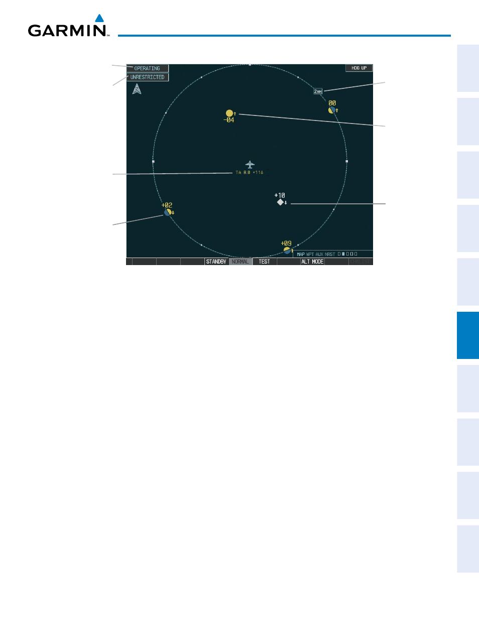
Figure 6-101 Traffic Map Page
Operating
Mode
Altitude
Mode
Traffic Advisory,
Aircraft is
400’ Below,
Climbing
Off Scale
Traffic
“Non-Bearing”
Traffic (Bearing
Undetermined),
Distance 8.0 nm,
1100’ Above,
Descending
Proximity
Traffic, 1000’
Above,
Descending
Traffic Display
Range
The Traffic Map Page shows surrounding TAS traffic data in relation to the aircraft’s current position and
altitude, without basemap clutter. Aircraft orientation is always heading up unless there is no valid heading.
Map range is adjustable with the RANGE Knob from 2 to 40 nm, as indicated by the map range rings.
The traffic mode and altitude display mode are annunciated in the upper left corner.
DISPLAYING TRAFFIC DATA
Traffic information can be displayed on the following maps when the KTA 870 unit is operating:
• PFD Inset Map
• Navigation Map Page
• Traffic Map Page
• Trip Planning Page
• Nearest Pages
• Active Flight Plan Page
Traffic information can also be displayed on the PFD when the Synthetic Vision System (SVS) option is
installed and enabled. See the Additional Features Section for details.
Displaying traffic information (maps other than the Traffic Map Page):
1)
Press the MAP Softkey.
2)
Press the TRAFFIC Softkey. Traffic is now displayed on the map.
When traffic is selected on maps other than the Traffic Map Page, a traffic icon is shown to indicate TAS is
enabled for display.