7 traffic information service (tis), Hazard avoidance – Garmin G1000 Socata TBM 850 User Manual
Page 392
Garmin G1000 Pilot’s Guide for the Socata TBM 850
190-00709-01 Rev. A
380
HAZARD AVOIDANCE
SY
STEM
O
VER
VIEW
FLIGHT
INSTRUMENTS
EAS
AUDIO P
ANEL
& CNS
FLIGHT
MANA
GEMENT
HAZARD
AV
OID
ANCE
AFCS
ADDITIONAL FEA
TURES
APPENDICES
INDEX
6.7 TRAFFIC INFORMATION SERVICE (TIS)
WARNING:
The Traffic Information Service (TIS) is intended for advisory use only. TIS is intended to help the
pilot locate traffic visually. It is the responsibility of the pilot to see and maneuver to avoid traffic.
NOTE:
TIS is available only when the aircraft is within the service volume of a TIS-capable terminal radar
site. Aircraft without an operating transponder are invisible to both Traffic Advisory Systems (TAS) and TIS.
Aircraft without altitude reporting capability are shown without altitude separation data or climb descent
indication.
NOTE:
TIS is disabled if a Traffic Advisory System (TAS) is installed.
Traffic Information Service (TIS) is designed to help in detection and avoidance of other aircraft. TIS uses the
Mode S transponder for the traffic data link. TIS receives traffic information from ground stations, and is updated
every 5 seconds. The G1000 displays up to eight traffic targets within a 7.5-nm radius, from 3000 feet below to
3500 feet above the requesting aircraft. Traffic is displayed according to TCAS symbology.
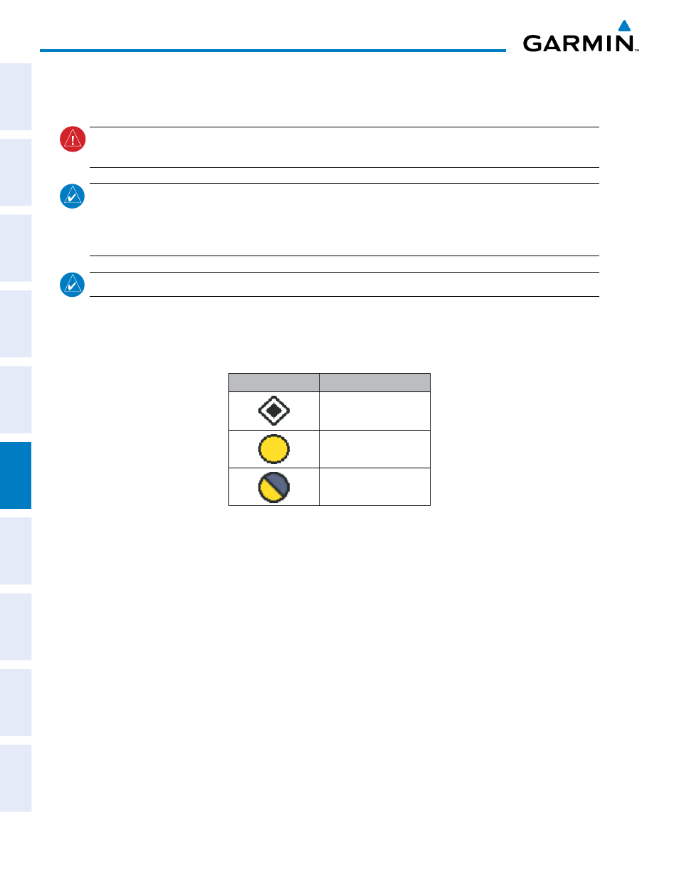
TIS Symbol
Description
Non-Threat Traffic
Traffic Advisory (TA)
Traffic Advisory Off Scale
Table 6-17 TIS Traffic Symbols
A Traffic Advisory (TA) indicates that the current track of the intruder could result in a collision. When traffic
meets the advisory criteria for the TA, a solid yellow circle symbol is generated. A TA which is detected, but is
outside the range of the map, is indicated with a message in the lower left corner of the map and a half TA symbol
at the relative bearing of the intruder.
TIS also provides a vector line showing the direction in which the traffic is moving, to the nearest 45°. Traffic
information for which TIS is unable to determine the bearing (non-bearing traffic) is displayed in the center of
the Traffic Map Page (Figure 6-98) or in a banner at the lower left corner of maps other than the Traffic Map Page
on which traffic can be displayed.