Garmin GPSMAP 5215 User Manual
Page 24
20
GPSMAP
®
4000/5000 Series Owner’s Manual
Charts and 3D Chart Views
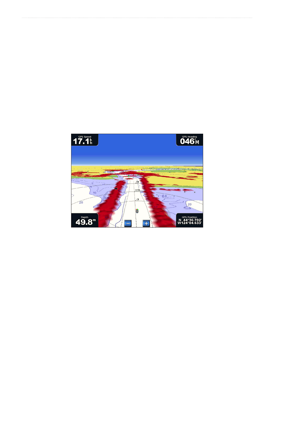
Selecting a Lane Width
You can indicate the width of the navigation lane appearing in Perspective 3D or Mariner’s Eye 3D.
Note: Mariner’s Eye 3D is available with a preprogrammed BlueChart g2 Vision data card.
1. From the Home screen, select Charts.
2. Select Perspective 3D or Mariner’s eye 3D.
3. Select Menu > Chart Appearance > Lane Width.
4. Enter the width.
5. Select Done.
Showing Surface Radar
The chartplotter must be connected to a marine radar to show surface radar.
You can show radar returns from the surface of the water in Perspective 3D or Mariner’s Eye 3D.
Note: Mariner’s Eye 3D is available with a preprogrammed BlueChart g2 Vision data card.
Perspective 3D with Surface Radar Information
1. From the Home screen, select Charts.
2. Select Perspective 3D or Mariner’s eye 3D.
3. Select Menu > Surface Radar > on.
Showing Other Vessels
See “Configuring the Appearance of Other Vessels” (
page 58
).
Showing and Configuring Data Bars
See “Data Bars” (
page 56
).
Using Waypoints and Tracks
See “Waypoints” (
) or “Tracks” (