Measuring distance, Setting up the map page – Garmin GPSMAP 196 User Manual
Page 41
Measuring Distance
You can measure the distance and bearing between two map items.
To measure the bearing/distance between two points:
1. From the Map Page, press
MENU to open the options menu.
2. Highlight the
Measure Distance option, and press ENTER.
An on-screen arrow appears on the map at your present
location with
ENT REF below it.
3. Move the arrow to the reference point (the starting point that
you want to measure from), and press
ENTER.
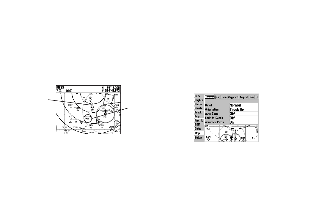
Measure Distance
End point of
measurement,
labeled “ENT
REF”
The beginning
point of the
measurement
4. Move the arrow to the point want to measure to. The bearing
and distance from the reference point and arrow coordinates
appear in the data window at the top of the screen.
5. Press
QUIT to finish.
The Map Page Setup allows you to adjust the way items appear on
the Map Page.
To change a map setup option:
1. From the Map Page, press
MENU to open the options menu.
2. Highlight
Setup Map, and press ENTER.
3. Highlight the
Map tab, and press ENTER.
4. Press left or right on the
ROCKER to highlight the tab, then
up or down on the
ROCKER to highlight to the field you want
to change, and press
ENTER.
General Tab of the Map Page Setup
5. Press up or down on the
ROCKER to highlight to the setting,
and press
ENTER to select the new setting.
6. Press
PAGE or QUIT to exit.
GPSMAP 196 Pilot’s Guide
33
A
VIATION
M
ODE
P
AGES
>
M
AP
P
AGE