Tips on creating a gps connection, Position requests, Landmarks – Nokia 5800EN User Manual
Page 63
Tips on creating a GPS connection
Check satellite signal status
To check how many satellites your device has found, and
whether your device is receiving satellite signals, select
Menu
>
Applications
>
Location
and
GPS data
>
Position
>
Options
>
Satellite status
.
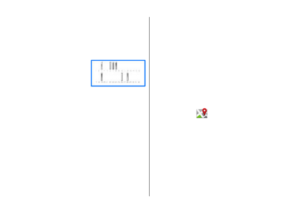
If your device has found satellites,
a bar for each satellite is shown in
the satellite info view. The longer
the bar, the stronger the satellite
signal. When your device has
received enough data from the
satellite signal to calculate the coordinates of your location,
the bar turns blue.
To view the positions of found satellites, select
Chg. view
.
Initially your device must receive signals from at least four
satellites to be able to calculate the coordinates of your
location. When the initial calculation has been made, it may
be possible to continue calculating the coordinates of your
location with three satellites. However, the accuracy is
generally better when more satellites are found.
If your device cannot find the satellite signal, consider the
following:
● If you are indoors, go outdoors to receive a better signal.
● If you are outdoors, move to a more open space.
● Ensure that your hand does not cover the GPS antenna of
your device.
● If the weather conditions are bad, the signal strength may
be affected.
● Some vehicles have tinted (athermic) windows, which
may block the satellite signals.
Position requests
You may receive a request from a network service to receive
your position information. Service providers may offer
information about local topics, such as weather or traffic
conditions, based on the location of your device.
When you receive a position request, a message is displayed
showing the service that is making the request. Select
Accept
to allow your position information to be sent or
Reject
to deny the request.
Landmarks
Select
Menu
>
Applications
>
Location
and
Landmarks
.
With Landmarks, you can save the position information of
specific locations in your device. You can sort the saved
locations into different categories, such as business, and add
other information to them, such as addresses. You can use
your saved landmarks in compatible applications, such as GPS
data.
GPS coordinates are expressed in the degrees and decimal
degrees format using the international WGS-84 coordinate
system.
Select
Options
and from the following:
Positioning (GPS)
© 2008 Nokia. All rights reserved.
63