Longitude error table (on 96 nm range scale), Ap-29 – Furuno FAR-2107 User Manual
Page 273
APPENDIX
AP-29
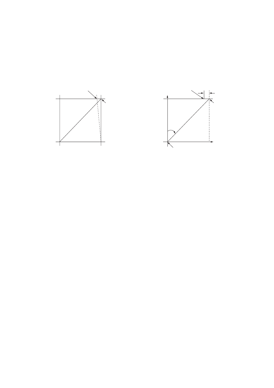
3. Longitude Error Table (on 96 nm range scale)
The longitude lines concentrate on the north pole and south pole, namely, 1 nm is
equivalent to 1 minute at 0 degree latitude, 2 minutes at 60 degrees latitude, 3 minutes at
70 degrees latitude and so on. For this reason, a longitude error occurs on the radar display.
For example, when own ship is at 60
°N and 135°E, even if the cursor indication is 62°N and
139
°E, the real cursor position is deviated to the left (west) side. The table below shows the
longitude error, represented from 0
° to 90° at 96 nm from the radar center (own ship).
62
°
N
°
N
60
°
N
135
°
E
°
E
96 nm
θ
Real cursor position
Cursor position
indicated
139
°
E
LAT
Real cursor position
R: Error
Cursor position
indicated
OS position
Distance error in direction of longitude due to latitude
- 2817-D (136 pages)
- 841 MARK-2 (58 pages)
- FAR-2157-BB (111 pages)
- UAIS TRANSPONDER FA-150 (4 pages)
- NAVNET 1763C (260 pages)
- FR-1710 (78 pages)
- FAR-2807 (52 pages)
- MARINERADAR FR-8062 (56 pages)
- 1935 (48 pages)
- FR-7062 (52 pages)
- FR-7252 (48 pages)
- COLOR VIDEO PLOTTER 1943C (251 pages)
- NAVPILOT 520 (73 pages)
- FAR-2167DS (111 pages)
- NAVpilot NAVpilot-500 (73 pages)
- FAR-2827 (135 pages)
- NAVNET 1823C (260 pages)
- FR-2155 (89 pages)
- FA-100 (58 pages)
- NAVNET 1943 (248 pages)
- 1622 (24 pages)
- FR-2115/2125 (79 pages)
- 1942 MARK-2 (52 pages)
- 1942 MARK-2 (46 pages)
- 2137S (123 pages)
- 1832 (62 pages)
- 1832 (64 pages)
- 1832 (63 pages)
- FAR-2167DS-D (111 pages)
- 821 (64 pages)
- FR-8251 (69 pages)
- FR-2135S (82 pages)
- FAR-2127-BB (136 pages)
- NX-700A/B (89 pages)
- MSC.36(63) (1 page)
- IF-1500AIS (12 pages)
- FR-8051 (64 pages)
- FAR-2157 (111 pages)
- FAR-2157 (8 pages)
- 1712 (27 pages)
- UAIS TRANPONDER FA-150 (128 pages)
- FAR-2107(-BB) (312 pages)
- NATVET 1824C (239 pages)
- NAVPILOT 500 (73 pages)