Map display screen – Horizon Navigation NavMate Car GPS Receiver User Manual
Page 52
38
Route Calculation and Guidance Screens
NavMate Navigation System
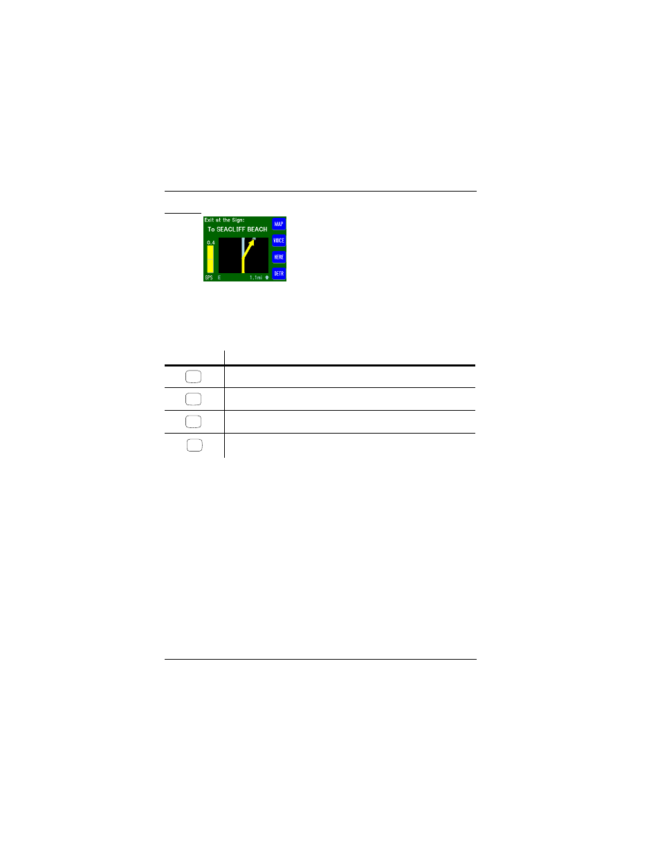
Screen 21. True View (Intersection) Screen
The True View (Intersection) automatically returns to a Guide Display screen
once the turn at the intersection has been completed.
The function buttons on this screen are described as follows:
Map Display Screen
The Map Display screen (which is similar to the Please Proceed screen)
shows the calculated route in pink. Major freeways are blue. Other streets are
shown in white. A green triangle icon indicates vehicle heading and location. A
yellow arrow indicates the direction to be traveled. Light green areas, as shown
in Screen 22, depict a park. Large blue masses depict water, like a lake or ocean.
Railroad tracks are shown in brown and airports are brown squares. When your
destination is within map view, it is marked with a “bull’s-eye” type icon.
In addition, the footer of the screen shows the GPS signal, directional
heading, zoom view level, and the distance to your destination at any time.
Table 13. True View (Intersection) Screen Function Buttons
Function Button
Press This Button to...
Display the Map Display screen.
Audible voice guidance is played (synchronized with screen display).
Show the Current Location screen.
Modify the calculated route with “detour” criteria. Refer to “Detours, Off-Route,
and Interruptions” on page 42
yellow line/arrow shows upcoming intersection.
left-side “meter” shows distance to intersection.
MAP
VOICE
HERE
DETR