Position tab, Satellites tab, Position tab -7 satellites tab -7 – Hand Held Products 7900 User Manual
Page 165
11 - 7
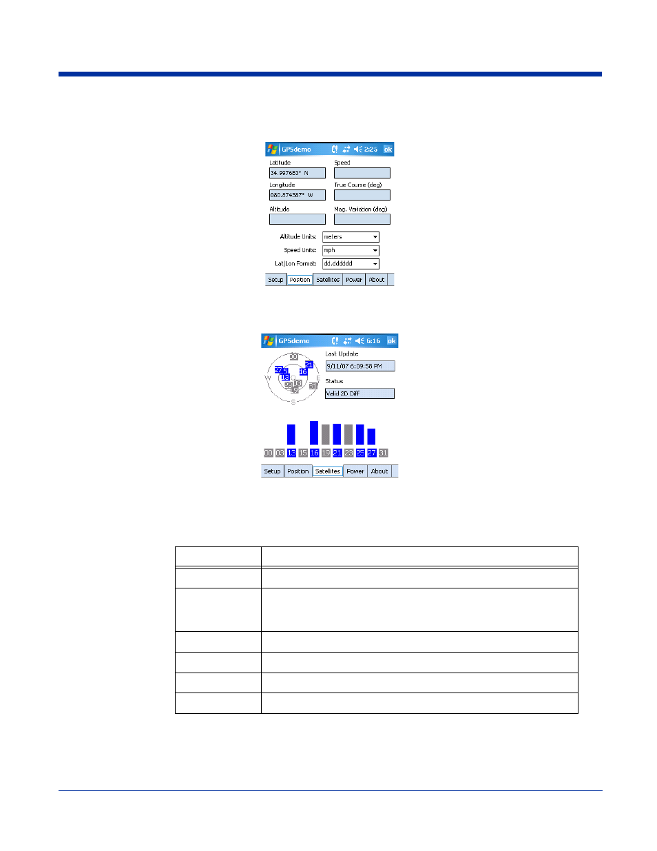
Position Tab
The Position tab displays the positional information that results from the incoming NMEA data string.
Satellites Tab
The Satellites tab displays the current GPS satellite constellation, which are the satellites in view of the terminal.
Vertical Bars
Vertical bars with a height greater than zero indicate tracking satellites.
Blue indicates that satellites are being used to determine the terminal’s position.
Gray indicates that satellites are not being used to determine the terminal’s position.
Last Update
Displays the date and UTC (Coordinated Universal Time) time of the last update attempt.
Status
Displays the status of the GPS connection and the satellites used to determine the position fix.
Status
Description
No Fix
There is not enough satellite information to determine position.
Estimated
The position is propagated simply by assuming that the receiver is
moving in the same direction and at the same speed as the last
calculated position.
Valid 2D
3 satellites are being used to determine fix.
Valid 2D Diff
3 satellites & a GPS Reference Station are being used to determine fix.
Valid 3D
4 satellites are being used to determine fix.
Valid 3D Diff
4 satellites & a GPS Reference Station are being used to determine fix.