Research Concepts RC2000C User Manual
Page 108
100
RC2000C Az/El Tracking Antenna Controller
Appendix G
Determining Satellite Inclination
Research Concepts, Inc. • 5420 Martindale Road • Shawnee, Kansas • 66218-9680 • USA
www.researchconcepts.com
Appendix G - Procedure for Determining Satellite Inclination
Satellite Inclination refers to the angle of the satellite orbit with the earth’s equatorial plane. Normal
satellite station-keeping maneuvers maintain the inclination near zero and the longitude to the assigned
position. Satellite fuel reserves may be extended if it is allowed to incline naturally and station-keeping
is maintained only in longitude. Whereas a geostationary satellite appears fixed in space, the apparent
position of a satellite in an inclined orbit varies with time.
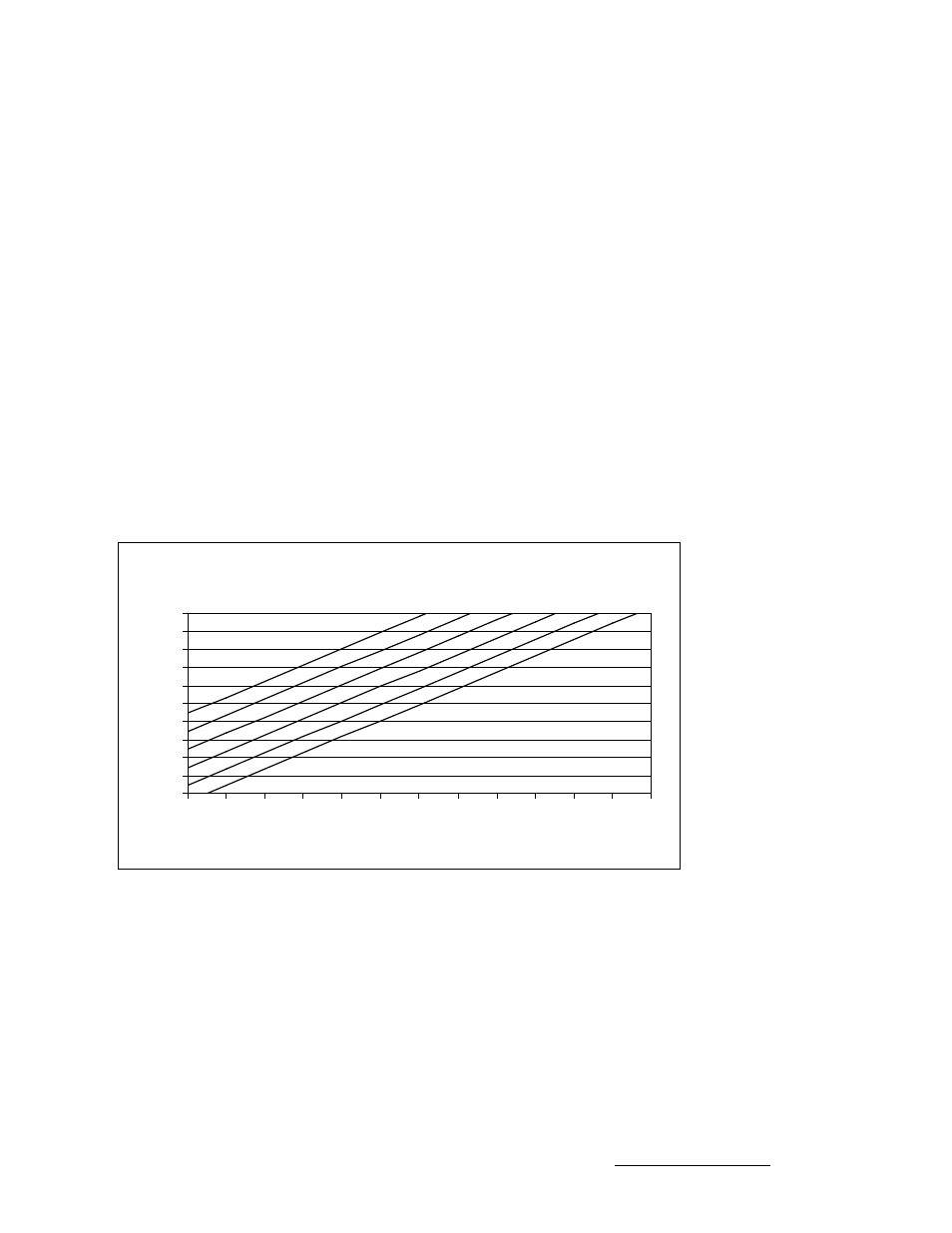
The pull of lunar and solar gravity combine to cause the inclination to naturally increase by 0.75 to 0.95
degrees per year. The figure below shows increasing inclination at the rate of 0.9 degrees per year for
satellites with various staring inclinations.
The Table below lists selected satellites, their longitude and inclination as of June 1998. To use the
figure with the tabular data: 1) Locate the June 1998 inclination from the table. 2) Find that point on the
left scale of the figure. 3) Move from that point parallel to the diagonal plotted lines out to the current
date. 4) The current estimated inclination is now read from the left scale of the figure. As an example
estimate the inclination of InSat 2A in March 2002. InSat 2A has a starting inclination of 0.8444
degrees. This point is shown on the graph with an ‘x’. For the year 2002 and 1/4th, the inclination is
shown by a ‘*’, about 4.2 degrees.
Satellite Inclination Nomograph Table
Estimated Satellite Inclination
0
1
2
3
4
5
6
7
8
9
10
1998 1999 2000 2001 2002 2003 2004 2005 2006 2007 2008 2009 2010
Year
In
clin
a
tio
n
, d
e
g
re
e
s
x
*