3 kinematic surveys, Surveying with gps – Leica Geosystems GPS Basics User Manual
Page 44
44
GPS Basics -1.0.0en
Surveying with GPS
5.1.3 Kinematic Surveys
The Kinematic technique is typically
used for detail surveying, recording
trajectories etc., although with the advent
of RTK its popularity is diminishing.
The technique involves a moving Rover
whose position can be calculated
relative to the Reference.
Firstly, the Rover has to perform what is
known as an initialization. This is
essentially the same as measuring a
Rapid Static point and enables the post-
processing software to resolve the
ambiguity when back in the office. The
Reference and Rover are switched on
and remain absolutely stationary for 5-20
minutes, collecting data. (The actual
time depends on the baseline length
from the Reference and the number of
satellites observed).
After this period, the Rover may then
move freely. The user can record posi-
tions at a predefined recording rate, can
record distinct positions, or record a
combination of the two. This part of the
measurement is commonly called the
kinematic chain.
A major point to watch during kinematic
surveys is to avoid moving too close to
objects that could block the satellite
signal from the Rover receiver. If at any
time, less than four satellites are tracked
by the Rover receiver, you must stop,
move into a position where 4 or more
satellites are tracked and perform an
initialization again before continuing.
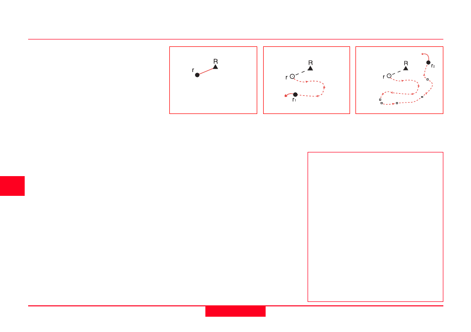
1
2
3
Initialization is performed
from the Reference to the
Rover.
The Rover can then move.
Positions can be recorded
at a predefined interval...
...and also at distinct
points if required.
Kinematic on the Fly
This is a variation of the Kinematic
technique and overcomes the require-
ment of initializing and subsequent re-
initialization when the number of
observed satellites drops below four.
Kinematic on the Fly is a processing
method that is applied to the measure-
ment during post-processing. At the
start of measurement, the operator can
simply begin walking with the Rover
receiver and record data. If they walk
under a tree and lose the satellites,
upon emerging back into satellite
coverage, the system will automatically
reinitialize.