Surveying with gps – Leica Geosystems GPS Basics User Manual
Page 38
38
GPS Basics -1.0.0en
Surveying with GPS
5. Surveying with GPS
Probably even more important to the
surveyor or engineer than the theory
behind GPS, are the practicalities of the
effective use of GPS.
Like any tool, GPS is only as good as its
operator. Proper planning and prepara-
tion are essential ingredients of a
successful survey, as well as an aware-
ness of the capabilities and limitations
of GPS.
Why use GPS?
GPS has numerous advantages over
traditional surveying methods:
1. Intervisibility between points is not
required.
2. Can be used at any time of the day or
night and in any weather.
3. Produces results with very high
geodetic accuracy.
4. More work can be accomplished in
less time with fewer people.
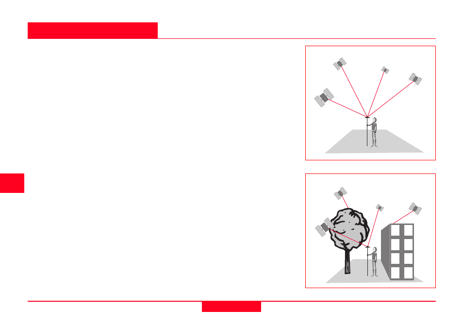
Limitations
In order to operate with GPS it is impor-
tant that the GPS Antenna has a clear
view to at least 4 satellites. Sometimes,
the satellite signals can be blocked by
tall buildings, trees etc. Hence, GPS
cannot be used indoors. It is also
difficult to use GPS in town centers or
woodland.
Due to this limitation, it may prove more
cost effective in some survey applica-
tions to use an optical total station or to
combine use of such an instrument with
GPS.
Clear view to four satellites
Large objects can block the GPS signal