Interpolation, One step, Stepwise – Leica Geosystems GPS Basics User Manual
Page 33: Interpolation approach, One step approach, Stepwise approach, Geodetic aspects
33
GPS Basics -1.0.0en
Geodetic Aspects
Other transformation approaches
Whilst the Helmert transformation
approach is mathematically correct, it
cannot account for irregularities in the
local coordinate system and for accurate
heighting, the geoid separation must be
known.
Therefore, Leica also makes a number
of other transformation approaches
available in its equipment and software.
The so-called Interpolation approach
does not rely on knowledge of the local
ellipsoid or map projection.
Inconsistencies in the local coordinates
are dealt with by stretching or squeezing
any GPS coordinates to fit homoge-
neously in the local system.
Additionally a height model can be
constructed. This compensates for lack
of geoid separations, provided sufficient
control points are available.
As an alternative to the Interpolation
approach the One Step approach may
be used. This transformation approach
also works by treating the height and
position transformations separately. For
the position transformation, the WGS84
coordinates are projected onto a tempo-
rary Transverse Mercator projection and
then the shifts, rotation and scale from
the temporary projection to the "real"
projection are calculated. The Height
transformation is a single dimension
height approximation.
This transformation may be used in
areas where the local ellipsoid and map
projection are unknown and where the
geoid is reasonably constant.
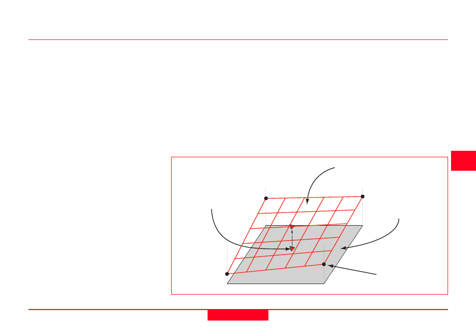
Point projected onto
height model surface
Height model
Ellipsoidal surface
Orthometric height
at common point
Height model generated from 4 known points
Both the Interpolation and the One Step
approach should be limited to an area of
about 15 x 15km, (10 x 10 miles).
A combination of the Helmert and
Interpolation approaches may be found
in the Stepwise approach. This ap-
proach uses a 2D Helmert transforma-
tion to obtain position and a height
interpolation to obtain heights. This
approach requires the knowledge of
local ellipsoid and map projection.