4 problems with height, Ellipsoid height, Geoid separation – Leica Geosystems GPS Basics User Manual
Page 30: Orthometric height, Geodetic aspects
30
GPS Basics -1.0.0en
Geodetic Aspects
P
H
N
h
4.4 Problems with height
The nature of GPS also affects the
measurement of height.
All heights measured with GPS are
given in relation to the surface of the
WGS84 ellipsoid. These are known as
Ellipsoidal Heights.
Existing heights are usually orthometric
heights measured relative to mean sea
level.
Mean sea level corresponds to a
surface known as the geoid. The Geoid
can be defined as an equipotential
surface, i.e. the force of gravity is a
constant at any point on the geoid.
The geoid is of irregular shape and
does not correspond to any ellipsoid.
The density of the earth does however
have an effect on the geoid, causing it to
rise in the more dense regions and fall
in less dense regions.
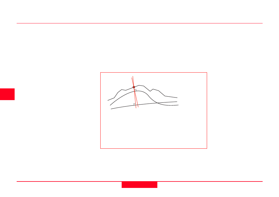
The relationship between the geoid,
ellipsoid and earths surface is shown
in the graphic below.
As most existing maps show
orthometric heights (relative to the
geoid), most users of GPS also require
their heights to be orthometric.
This problem is solved by using geoidal
models to convert ellipsoidal heights to
orthometric heights. In relatively flat
areas the geoid can be considered to be
constant. In such areas, use of certain
transformation techniques can create a
height model and geoidal heights can
be interpolated from existing data.
Topography
Ellipsoid
Geoid
h = H+N
where
h = Ellipsoidal Height
H = Orthometric Height
N = Geoid Separation
Relationship between Orthometric
and Ellipsoidal height