Creating a waypoint at your present position – BendixKing KLN 35A - Pilots Guide System KLN 35A User Manual
Page 125
To delete a user-defined waypoint that is no longer needed, see
section 3.13.2
, "Viewing and Deleting User Waypoints and Waypoint
Remarks".
4.4.1. CREATING A WAYPOINT AT YOUR PRESENT POSITION
Creating a waypoint at your present position is the simplest possible
way to create a user-defined waypoint. This is nice for
"remembering" a spot you are at. Let's suppose you're at a private
strip that you want to name "VALLY"
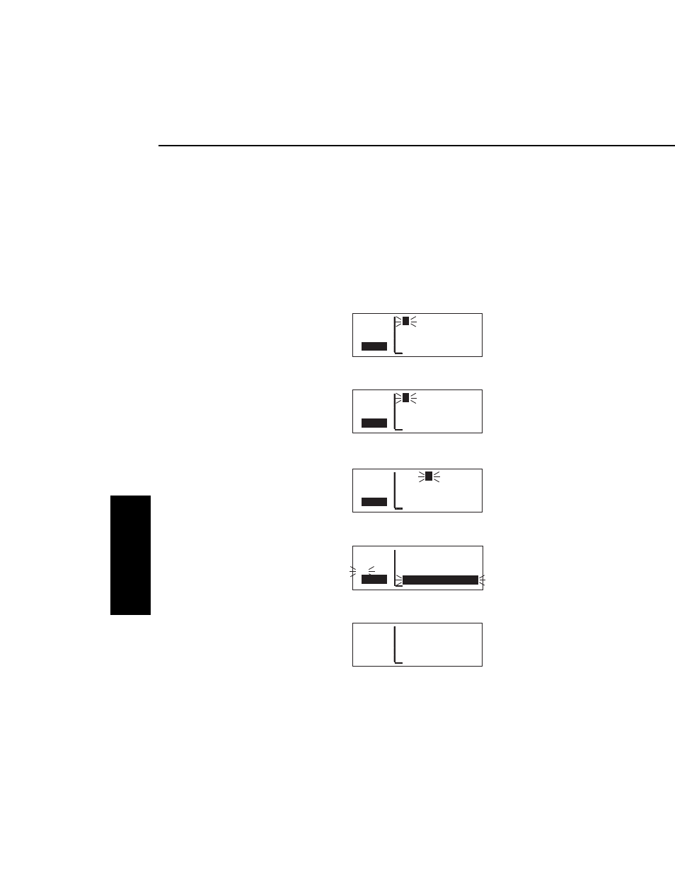
To create a user-defined waypoint at your present position:
1.
From any supplemental waypoint
(SUP) page, turn on the cursor
(
B
). It will flash over the first
character in the waypoint
identifier field (figure 4-74).
2.
Use the right inner knob to select
the first character of the identifier
(figure 4-75). Remember that
when the cursor is on, the right
inner knob changes the character
and the right outer knob moves
the cursor around.
3.
Spell out the rest of the identifier
using the right inner and outer
knobs (figure 4-76).
4.
Move the cursor down to the
fourth line, over Present Pos?
(figure 4-77).
5.
Press
F
. The SUP 1 page for
your new waypoint will be
displayed with its latitude and
longitude (figure 4-78). The
cursor is turned off automatically.
Advanced GPS Operation
4-22
Effective Date 5/95 006-08791-0000 Rev 0
Advanced GPS Operation
Chapter 4
APT VOR NDB SUP ACT NAV FPL CAL SET OTH
åå.ånm VALL
Y
USR at:
ееееее User Pos L/L?
>Leg User Pos R/D?
CRSR
Present Pos?
Figure 4-76
APT VOR NDB SUP ACT NAV FPL CAL SET OTH
åå.ånm VALLY USR at:
ееееее User Pos L/L?
#>Leg User Pos R/D?
CRSR
Present Pos?
Figure 4-77
APT VOR NDB SUP ACT NAV FPL CAL SET OTH
åå.ånm VALLY USR
ееееее N 38°30.25'
>Leg W 95°18.54'
SUP 1 >111°TO 0.2nm
Figure 4-78
APT VOR NDB SUP ACT NAV FPL CAL SET OTH
åå.ånm
V
USR at:
ееееее User Pos L/L?
>Leg User Pos R/D?
CRSR
Present Pos?
Figure 4-75
APT VOR NDB SUP ACT NAV FPL CAL SET OTH
åå.ånm
F
ARM USR
ееееее N 38°49.74'
>Leg W 97°30.28'
CRSR
>274°To 105nm
Figure 4-74