Navigat ion, Map operation and settings – Mercedes-Benz GLK-Class 2012 COMAND Manual User Manual
Page 90
X
Select
Arrival Time / Distance
,
Current Street
,
Geo-coordinates
or
None
and press W to confirm.
X
To exit the menu: slide XVY the COMAND
controller.
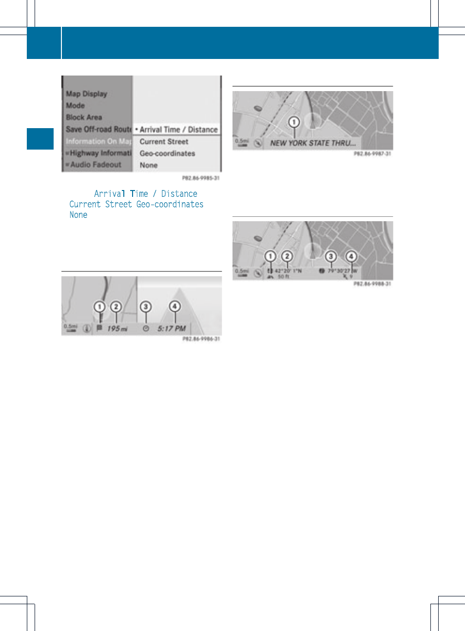
Arrival time/distance to the destination
Arrival time/distance display switched on
:
Icon for destination
;
Distance to the destination
=
Icon for estimated time of arrival
?
Estimated time of arrival
You can only see this display during route
guidance. While scrolling the map
(
Y
page 59), you will see additional data, e.g.
road names, depending on the crosshair
position, if the digital map supports this data.
i
During route calculation, or if the vehicle
is traveling on a non-digitized road, the
linear distance to the destination is shown.
In this case, the display will be grayed out.
Road display
Road display active
:
Road names or numbers, e.g. for
highways
Geo-coordinate display
Geo-coordinate display active
:
Current height above average sea level,
rounded
;
Current vehicle position: latitude
coordinates
=
Current vehicle position: longitude
coordinates
?
Number of GPS satellites currently being
used
There must be sufficient GPS reception for all
displays to be shown. If this is not the case,
the display will be grayed out. Height
display : may vary from the actual value,
because the navigation system uses the GPS
signals for the calculation.
While scrolling the map (
Y
page 59), you will
see the geo-coordinates of the crosshair
position. Height display : and number of
satellites used ? are not displayed.
88
Map operation and settings
Navigat
ion