Navigat ion, Map operation and settings – Mercedes-Benz GLK-Class 2012 COMAND Manual User Manual
Page 87
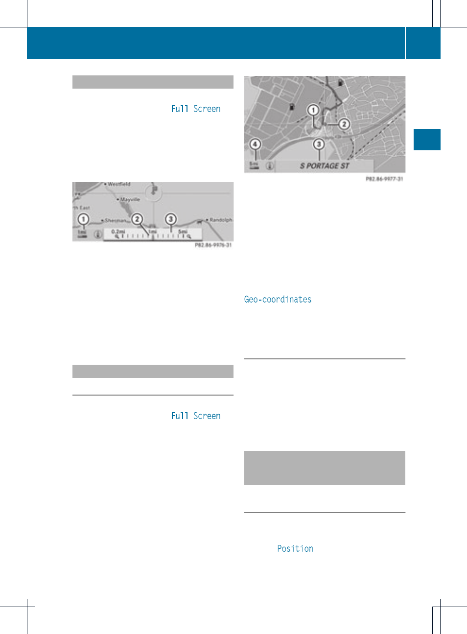
Setting the map scale
X
To hide the menu: slide ZV the COMAND
controller and, when the
Full Screen
menu item is shown, press W.
X
To call up the scale bar: as soon as you
turn cVd the COMAND controller, scale
bar = appears.
X
Turn cVd until the desired scale is set.
:
Set map scale as a number with unit
;
Currently set map scale as indicated by
the needle on the scale bar
=
Map scale
Unit of measurement : in the COMAND
display depends on the selection made for the
instrument cluster (see the vehicle
Operator's Manual).
Moving the map
Showing the crosshair
X
To hide the menu: slide ZV the COMAND
controller and, when the
Full Screen
menu item is shown, press W.
X
To scroll the map: slide XVY, ZVÆ or
aVb the COMAND controller.
A crosshair appears on the map. If you slide
it again, the map moves in the
corresponding direction under the
crosshair.
Map with crosshair
:
Current vehicle position
;
Crosshair
=
Details of the crosshair position
?
Map scale selected
Display = may be the name of a street, for
example, provided the digital map contains
the necessary data. It may also show the geo-
coordinate position of the crosshair if the
Geo-coordinates
display is switched on
(
Y
page 88).
Hiding the crosshair and centering the
map on the vehicle position or
destination
X
Press the k back button twice.
The crosshair disappears and the map is
set to the vehicle position.
or
X
Set the map to the vehicle position; see the
explanation below.
Setting the map to the vehicle
position, destination or intermediate
stop
Centering the map on the vehicle
position
X
To show the menu: press W the COMAND
controller.
X
Select
Position
in the navigation system
menu bar by sliding VÆ and turning cVd
Map operation and settings
85
Navigat
ion
Z