Map summary, Traffic summary – Telenav for Sprint Supported Devices: v5.8 for Android devices User Manual
Page 29
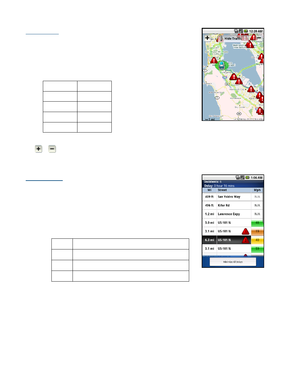
Map Summary
The entire route from your starting location to your destination is drawn on a map,
complete with the latest traffic alerts and traffic flow information. The route is
displayed as a blue line connecting the Start and Finish flags. When available, select
an on-screen alert to read traffic details.
Highways and major roads with traffic flow information are color-coded by speed
in each direction of travel:
Speed Road
Color
>> 50 mph
Green
30 - 50 mph
Yellow
< 30 mph
Red
Unknown Grey
Tap Hide Traffic or Show Traffic (depends on availability).
Tap
or
to zoom in or out of the map (you can also choose these options by calling up the menu). Use the
trackball to pan the map. On touch-screen devices, you can slide your finger across the screen to pan.
NOTE:
To go back to Moving Map view, press the Back button.
Traffic Summary
Displays overall delay from traffic, a summary of incidents on the route, and the
average speed for each segment where available. You can tap on any line to
view more details.
Below is an explanation of what you will see on the Traffic Alert screen:
Incidents (triangle icons) - Total number of remaining incidents
directly along the route. The color of the triangle indicates incident
severity:
Color Severity
Yellow
Only Minor incidents
Orange At least one Major incident, no severe incidents
Red
At least one Severe incident
Delay - Total time delay caused by traffic conditions, or the sum of delays on each segment.
NOTE:
Delay refers only to the route currently shown.
Mi - Distance until next turn.
NOTE:
This is not the distance from the origin but the length of each road segment.
© 2010 TeleNav, Inc.
Page 29 of 71