Map page options – Garmin GPSMAP 3010C User Manual
Page 47
GPSMAP 3006C/3010C Owner’s Manual
3
M
aIn
P
ages
>
M
aP
P
age
M
aI
n
p
aG
es
Map Page Options
The Map Page provides access to functions and features relating to the Map Page
(or Map function window) using the ADJ key and soft key options. The available
options are: Measure (Distance), hide (Show) Detail, and Setup. As you add
optional hardware to the chartplotter or Garmin Marine Network, additional
adjustment menu choices may appear automatically
You can customize the Map Page to show other functions and different sizes or
types of Digital Data fields.
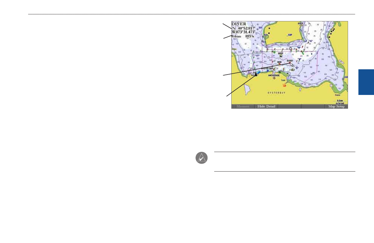
Measuring Distance
Use the Measure (Distance) option to measure the distance and bearing between
two points.
To measure the distance and bearing between two points:
1. Press the
Measure soft key. An on-screen pointer appears on the map
display at your present location with a blue thumbtack symbol to show the
“From” reference point.
2. Using the
ROCKER, move the pointer to the reference point (the point
from which you want to measure), and press
ENTER. The blue thumbtack
symbol now appears at that point.
3. Move the pointer to the point from which you want to measure. The
bearing and distance from the reference point and pointer coordinates
appear in the upper-left corner of the Map Page.
4. Press
QUIT to finish.
Measuring Distance
(BlueChart Data Shown)
Dstance
and
bearng
Ponter
coordnates
To
reference
pont
From
reference
pont
Hiding and Showing Map Details
Use the hide Detail (Show Detail) soft key to show or hide Spot Soundings and
Map Outlines for easier viewing.
NOtE: This setting only affects the currently selected map. If you have a
second map window shown, you can set one map to show detail and one map
to hide detail.