To monitor your gps status in navmode, Speed, Monitoring gps satellite information – DeLorme Topo North America 9.0 User Manual
Page 178: Dilution of precision, Satellite listing
DeLorme Topo North America 9.0 User Guide
174
insufficient satellite data to determine your GPS position. This usually
indicates insufficient data for an accurate location due to:
• Only three satellites being used
• Poor signals from the satellites.
Move your receiver to another location until you get better reception.
3-D–A green circle indicates the GPS receiver is receiving sufficient satellite
data to determine your location. When the status reads 3-D, your current
coordinates, elevation, and heading are displayed, along with the speed you
are currently traveling.
Note If you are tracking with a WAAS-enabled device, a 3-D fix displays as
"3-D DGPS."
To Monitor Your GPS Status in NavMode
In NavMode, you can view your speed. To view other GPS status information, use the tab
view.
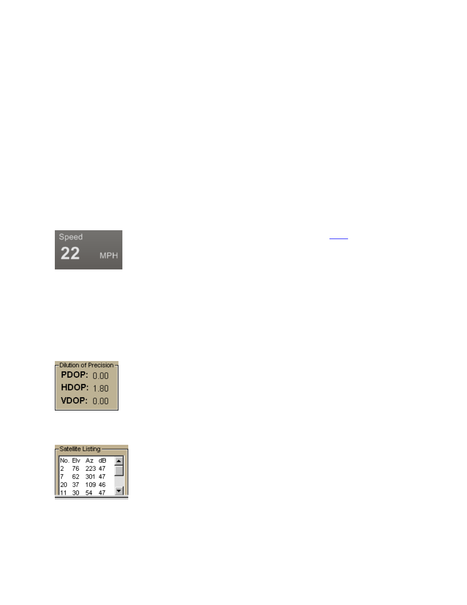
Speed
Displays the speed you are traveling based on the
on the Display tab in the Options dialog box.
Monitoring GPS Satellite Information
Click Sat. Info in the GPS tab to view the current satellite status. Sat. Info is a toggle
button that switches to Status. Click Status to return to the original Status dialog area.
Dilution of Precision
The Dilution of Precision area lists your Position Dilution of Precision,
your Horizontal Dilution of Precision, and your Vertical Dilution of
Precision. For definitions of these terms, see Glossary Terms.
Satellite Listing
The Satellite Listing window displays the satellites that are
currently visible in the sky. The columns list the satellite number,
elevation, azimuth, and signal-to-noise ratio.
Satellite Listing information is only available for DeLorme receivers
and NMEA-compatible receivers.