Map setup – AvMap EKP V User Manual User Manual
Page 10
Aeronautical Navigator
AvMap EKPV
10
- Quick Manual
Aeronautical Navigator
AvMap EKPV
Quick Manual -
11
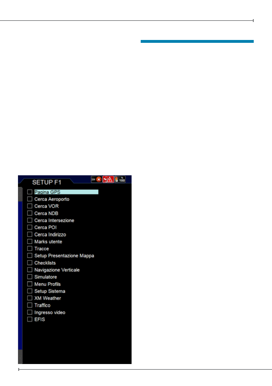
F1 is a button that can be set up to be
associated with several functions.
In order to set it up:
• Push MENU button and then F1 button
• The list of the possible functions that can
be associated with this button appears on
the screen. Choose the favorite functions
among the listed ones.
• Push ESC button to come back to the
map.
After you set up it, whenever you push F1
button during the navigation, the customized
menu will be opened and using it you will
able to access to all your favorite functions.
If you set up only one function for this
button, F1 will allow you to access directly to
it, without opening a menu window.
7. Map Setup
The Map Setup menu is the first menu
available in the top menu bar of the main
menu page. In this menu it is possible to
optimise the map details and information
based on the navigational need and
conditions.
Map Visualization
:
This section permits to setup maps
presentation, the map orientation and the
auto position mode.
Presentation Setup
The Presentation setup menu gives you
the possibility to setup 3 different map
presentations.
Each Map presentation is defined on Cycle 1,
Cycle 2, and Cycle 3 on users preference.
For each cycle you can select what map
type you want to see, and at the same time
for each map presentation you can choose
what objects and airspaces you want to
enable in that specific map presentation.
Once you setup this menu you can easily
change the visualization of the map by
selecting the CYCLE button. Every time
you touch the CYCLE button the map
visualization will be modified according to
the pre-defined customized cycles.
On the Presentation setup you select for
each Cycle the type of Map to be used:
-
Map :
Geographic Terrestrial Background map
with or without Land Elevation (Land
Elevation visualization can be enabled or
disabled in OBJECTS for each cycle).
-
TAWS :
Terrain Awareness Warning System.
TAWS highlights safe and unsafe elevation
for an easier to read map display. TAWS