Gnss status – Spectra Precision ProMark 120/220 Handheld Platform User Manual
Page 39
English
33
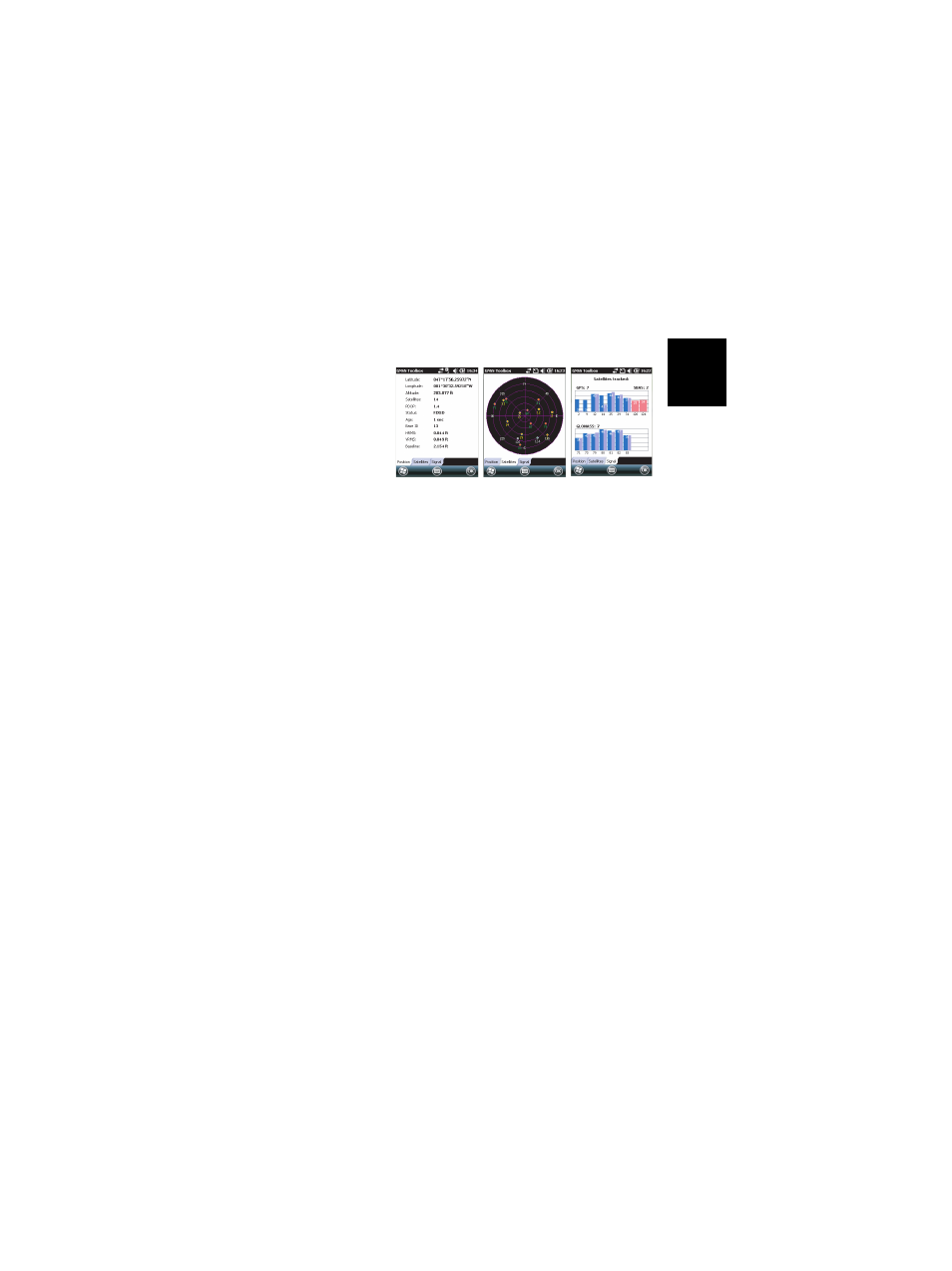
GNSS Status
•
Open the
GNSS Toolbox and tap on GNSS Status.
The default
Position tab shows the latitude, longitude and
altitude of the current position, as computed by the
receiver, as well the number of satellites used and the
current PDOP value.
If SBAS is used, the screen also shows the position status
(SDGPS) and the age of corrections.
In RTK mode, the screen additionally shows the HRMS
and VRMS, the baseline length, the base ID and, if the
receiver has not fixed the position yet, the estimated time
before a new fixed position is available (
Time to FIXED
parameter).
The unit used to express the current altitude, HRMS,
VRMS and baseline length (meters or feet) depends on the
region (language and country) you selected in
Settings,
System, Regional Settings.
•
The
Satellites tab displays a polar diagram showing the
locations in the sky of the tracked satellites. Different
colors are used to display the numbers of the visible
satellites:
– Yellow characters: GPS satellites used
– Green characters: GLONASS satellites used
– Grey characters: Visible SBAS satellites. Also rejected
GPS and GLONASS satellites, because unhealthy or
under the elevation mask.
•
The
Signal tab shows the signal level for each of the
tracked satellites:
– Contiguous dark blue (L1) and light blue (L2) bars for
all GPS and GLONASS satellites used
– Red bars for all SBAS or QZSS satellites used
– Contiguous dark grey (L1) and light grey (L2) bars for
all tracked, but not used, GPS and GLONASS satellites