Reference – Garmin GPS 150 User Manual
Page 38
To display the Airport Position page:
1. Rotate
O
until the Airport Position page is displayed (with the cursor not flashing).
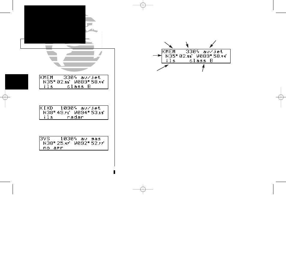
The fields on the Airport Position page display the following information:
Elevation
- In feet or meters.
Usage/Fuel
- If the airport is for military use, it will display ‘military’. If it
is private, the GPS 150 will display ‘private’. If it is a public
airport, it will display the fuel type(s) available:
• av gas - 80-87 octane, 100 LL, 100-130 octane, or mogas
• jet
- Jet A, Jet A-1, or Jet A+
• av/jet - Both av gas and jet are available
Approach Info - displays the airport approaches available:
• no apr - No approach is available.
• np-apr - Non-precision approach is available.
• loc -
Localizer approach is available.
• ils -
ILS approach is available.
28
REFERENCE
Airport Position Page
Section
2
Airport Position page for KIXD.
Airport Position page for KMEM.
Airport Position page for 3VS.
Identifier
Controlled airspace
type or radar capability
Usage/Fuel
Elevation
Approach
information
Position (lat/lon)
150man rev E 7/24/98 3:10 PM Page 28