5 airport approach page – Garmin GNS 430 User Manual
Page 124
GNS 430(A) Pilot’s Guide and Reference
190-00140-00 Rev. P
7-8
SECTION 7
WPT PAGES
The following descriptions and abbreviations are used
on the Airport Frequency Page:
• Type - Usage type: Public, Heliport, Military, or
Private
• Frequency - Communication frequencies which
may include restrictions:
Approach
Arrival
Class B
Class C
CTA
Departure
TMA
Terminal
TRSA
Communication frequencies without restrictions:
ATIS
ASOS
AWOS
Center
Clearance
Gate
Control
Ground
Helicopter
Multicom
Pre-taxi
Radar
Ramp
Other
Tower
Unicom
Navigation frequencies:
ILS
LOC
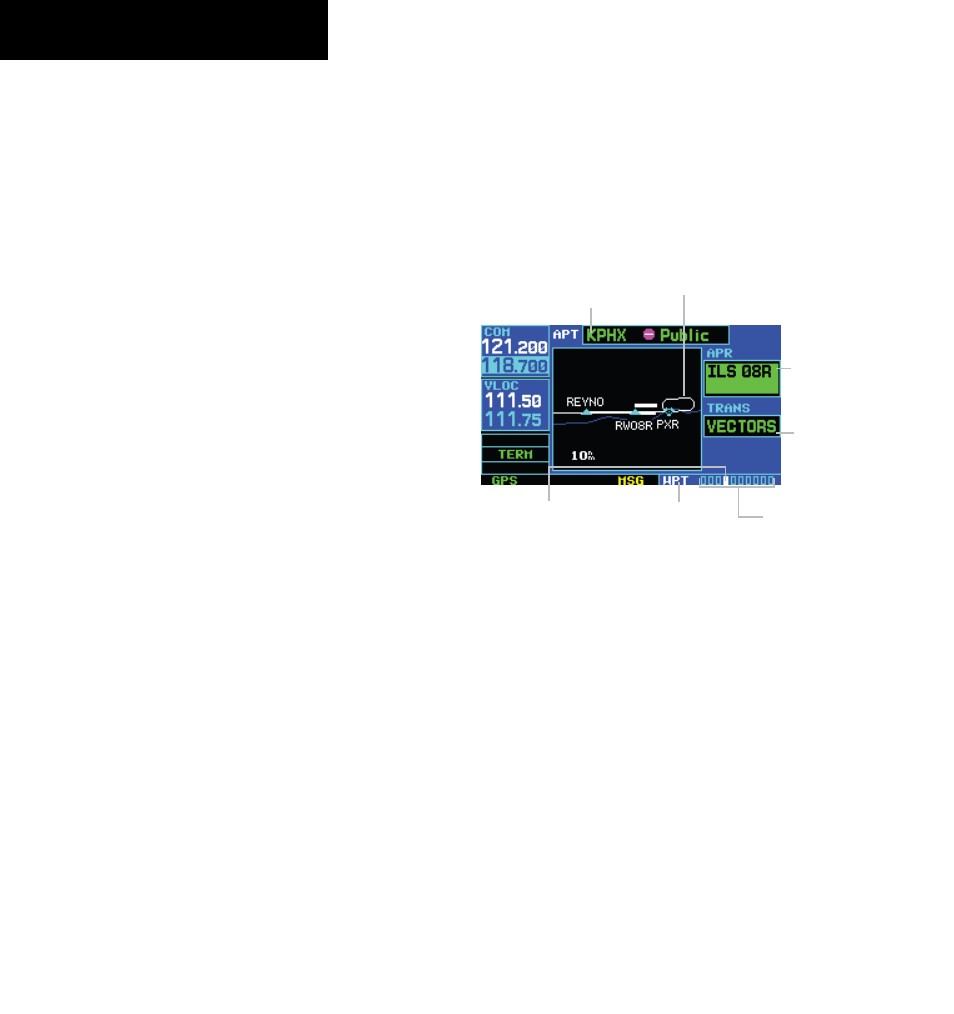
7.5 AIRPORT APPROACH PAGE
The Airport Approach Page (Figure 7-17) shows the
available approach procedures for the selected airport.
Where multiple initial approach fixes (IAFs) and feeder
routes are available, that information may also be
displayed. A map image provides a layout diagram for
each approach and transition.
Figure 7-17 Airport Approach Page
Airport Identifier,
Symbol, and Type
Map Image
Approach
Procedure
Name
Transitions:
IAF’s, Feeder
Routes, and
Vectors-to-Final
Position of Current Page
within Current Page Group
Number of Pages in
Current Page Group
Current
Page Group
To scroll through the available approaches
and transitions:
1) Press the small right knob to activate the
cursor.
2) Turn the large right knob to place the cursor
on the approach (APR) procedure name field
(Figure 7-17).