2d chart enhancements, Introduction – Raymarine Platinum Chart Card User Manual
Page 8
4
Navionics Platinum Chart Card - User’s Guide
2D Chart Enhancements
Introduction
The Navionics Platinum chart card provides additional features that enhance the 2D
cartography described in your display’s manual.
New Port Services
• Panoramic photos.
• Pilot book information.
New cartographic objects
• Business services information.
• Additional wrecks data.
• Major coastal roads.
• Panoramic photos.
New features
In addition to Radar Overlay, Chart Layers now includes:
• Aerial photo overlay.
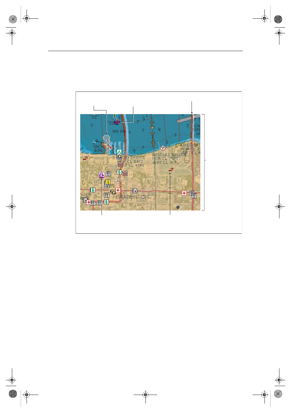
D7924_1
Port services
(now includes Panoramic Photo
and Pilot Book information)
Business services
information
Panoramic photo symbol
(also accessed via Port Services)
Major coastal roads
Additional wreck data
(when available)
Aerial photo overlay
(60%, land and sea)
81259_1_NGC.book Page 4 Wednesday, July 27, 2005 11:51 AM
- RAYTHEON E32001 (13 pages)
- RAYCHART 420 (101 pages)
- L365 (83 pages)
- SR50 (48 pages)
- A65 (100 pages)
- RS12 (50 pages)
- DSM300 (82 pages)
- NMEA Multiplexer (16 pages)
- Pathfinder (111 pages)
- Pathfinder Radar (244 pages)
- autopilot control unit (111 pages)
- VolvoPenta IPS Autopilot System DPU (16 pages)
- autopilot + ST4000+ (145 pages)
- stand-alone master instrument (45 pages)
- ST80 (15 pages)
- Raystar 125 (8 pages)
- RS12 (38 pages)
- ST6001 (48 pages)
- Pathfinder Radar Scanners (66 pages)
- Chartplotter (101 pages)
- Heading Sensor (24 pages)
- Ray430 (54 pages)
- Viewable Marine Displays (38 pages)
- Marine GPS System (188 pages)
- C Series (244 pages)
- ST8001 (48 pages)
- hsb2 PLUS Series (246 pages)
- 631 PLUS (170 pages)
- navigation system (17 pages)
- ST8002 (48 pages)
- PowerPilot (18 pages)
- ST7002 (52 pages)
- GPS Kit (24 pages)
- 465 (107 pages)
- Ray54E (116 pages)
- GPS Plotter (131 pages)
- GPS navigation (75 pages)
- ST7001 (48 pages)
- 300 (136 pages)
- Raystar 120 (30 pages)
- autopilot (137 pages)
- DSM30 (34 pages)
- ST6002 (56 pages)
- 320 (139 pages)