Additional wrecks, Major coastal roads – Raymarine Platinum Chart Card User Manual
Page 13
2D Chart Enhancements
9
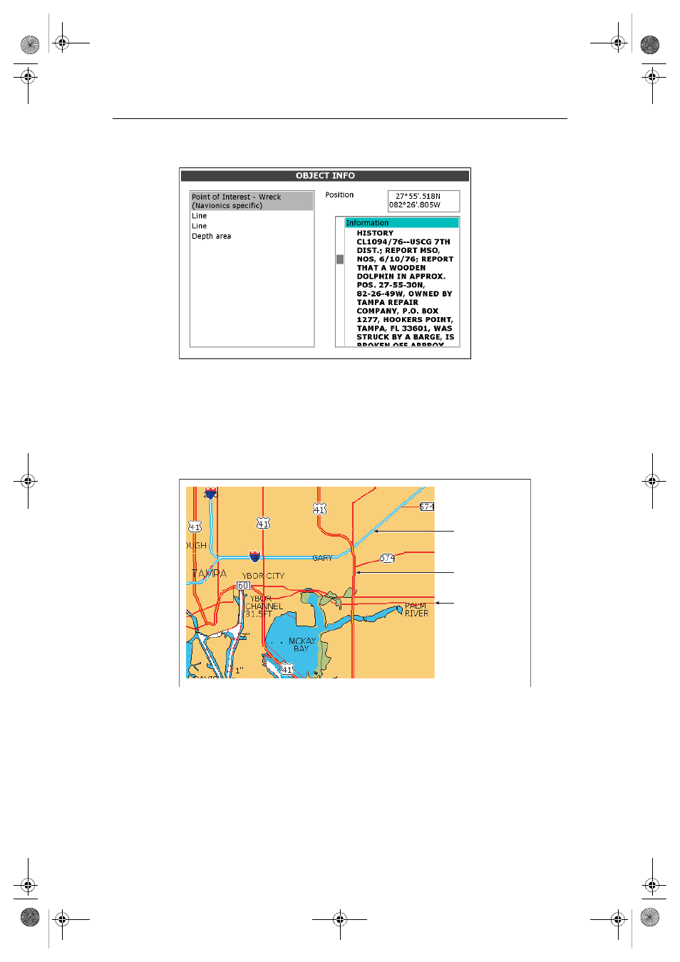
Additional wrecks
Navionics Platinum cartography provides details of wrecks that you would find on a
paper chart together with detailed data for additional wrecks.
To display additional information about the object, select the wreck on the Object Info
screen.
Major coastal roads
With Platinum cartography you can view coastal interstate and state highways,
motorways and other major roads.
Note:
If the aerial overlay feature (see page 10) is switched on and set to Land and Sea Mode
in the Cartography Setup Menu, these roads will fade as the level of opaqueness is decreased.
D7929_1
Interstate highway/
Motorways
State highway/
Major roads
Highways/
Minor roads
D7919_1
81259_1_NGC.book Page 9 Wednesday, July 27, 2005 11:51 AM
See also other documents in the category Raymarine GPS receiver:
- RAYTHEON E32001 (13 pages)
- RAYCHART 420 (101 pages)
- L365 (83 pages)
- SR50 (48 pages)
- A65 (100 pages)
- RS12 (50 pages)
- DSM300 (82 pages)
- NMEA Multiplexer (16 pages)
- Pathfinder (111 pages)
- Pathfinder Radar (244 pages)
- autopilot control unit (111 pages)
- VolvoPenta IPS Autopilot System DPU (16 pages)
- autopilot + ST4000+ (145 pages)
- stand-alone master instrument (45 pages)
- ST80 (15 pages)
- Raystar 125 (8 pages)
- RS12 (38 pages)
- ST6001 (48 pages)
- Pathfinder Radar Scanners (66 pages)
- Chartplotter (101 pages)
- Heading Sensor (24 pages)
- Ray430 (54 pages)
- Viewable Marine Displays (38 pages)
- Marine GPS System (188 pages)
- C Series (244 pages)
- ST8001 (48 pages)
- hsb2 PLUS Series (246 pages)
- 631 PLUS (170 pages)
- navigation system (17 pages)
- ST8002 (48 pages)
- PowerPilot (18 pages)
- ST7002 (52 pages)
- GPS Kit (24 pages)
- 465 (107 pages)
- Ray54E (116 pages)
- GPS Plotter (131 pages)
- GPS navigation (75 pages)
- ST7001 (48 pages)
- 300 (136 pages)
- Raystar 120 (30 pages)
- autopilot (137 pages)
- DSM30 (34 pages)
- ST6002 (56 pages)
- 320 (139 pages)