The application – Raymarine Platinum Chart Card User Manual
Page 17
3D Cartography
13
• Ability to synchronize 2D and 3D charts.
• Ability to indicate the area that your fishfinder transducer cone covers (if fitted).
To obtain the best results from the 3D cartography application you should make sure
that your display is receiving accurate heading and position data from a suitable
source.
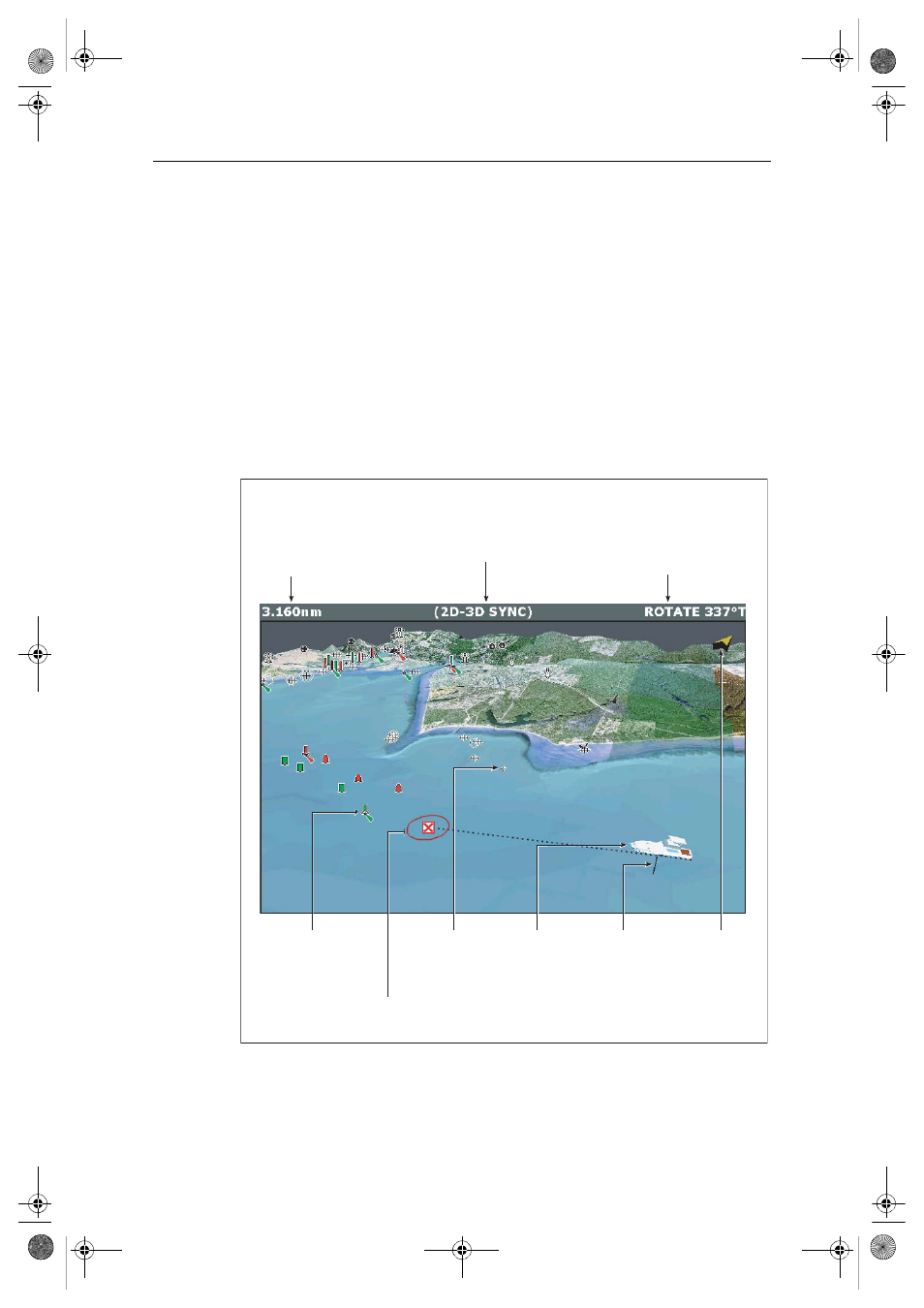
The application
When you choose to set up your display to use 3D cartography, the application opens
in the selected window. Depending on how your display is set up, this can be full
screen, or part of a page set.
For full details of Page Set up refer to your display handbook.
Mode
Shows the mode in
which the application
is working.
Rotation
Shows in degrees true,
how far the on-screen
view has been rotated
from your boat's heading
.
Range
Horizontal distance across screen
(halfway up the window or at
center of view).
Shown in selected system units.
Boat symbol
Boat's position
on chart. Select
sail or power
boat.
Center-of-view
White cross
indicates center of
chart view.
North arrow
3D indication
of True North
in relation to
the chart view.
Depth scale
Approximate
depth beneath
your boat.
Waypoint
With arrival circle
Cartographic objects
Select objects for display
via the 3D Chart Setup
menu.
D8054_1
81259_1_NGC.book Page 13 Wednesday, July 27, 2005 11:51 AM