Lowrance electronic AirMap 1000 User Manual
Page 61
55
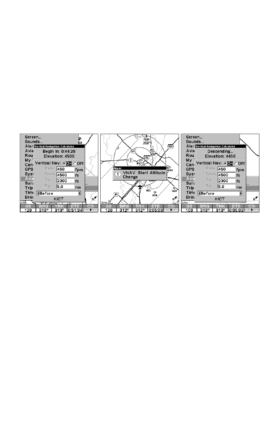
The solution to our vertical navigation problem shows at the top of the
screen. Our current altitude is 4500 feet and at our current airspeed,
we should begin our descent in 44 minutes and 20 seconds. If we main-
tain a 450 fpm descent starting in about 44 minutes, then we should
reach pattern altitude 5 nautical miles before we reach the airport.
You can watch the clock count down your approach. If you increase
your speed, the clock will decrease more quickly. If you slow down, it
will take longer. Either way, when you reach the point at which you
should begin your descent, the box at the top of the screen changes.
Now in place of the timer, it indicates that you should be descending.
Above that, it shows the altitude you should be at.
Vertical Navigation Calculator
- 200 (61 pages)
- 3200 (128 pages)
- IFINDER PRO (132 pages)
- X107CDF (92 pages)
- 988-0161-011 (60 pages)
- Lowrance GlobalMap 9300C HD (168 pages)
- 500 (132 pages)
- Nautic Insight HDS-5m (48 pages)
- Lowrance GlobalMap 6600C HD (144 pages)
- Lowrance iWAY 250C (76 pages)
- Handheld Mapping GPS Receiver (140 pages)
- LMS 330C (216 pages)
- GlobalMap 4800M (132 pages)
- GlobalMap 1600 (92 pages)
- Lowrance GlobalMap Baja 480C (140 pages)
- LMS-339cDF iGPS (204 pages)
- X96TX (84 pages)
- 4900M (136 pages)
- HD LCX-110C (208 pages)
- Lowrance iFINDER GO (16 pages)
- Lowrance iFINDER H2O C (132 pages)
- iFINDER H2O (124 pages)
- Lowrance GlobalMap 3500C (136 pages)
- 3600C (136 pages)
- 310 (65 pages)
- LMS-525C DF (252 pages)
- LMS-332C (216 pages)
- H2O (124 pages)
- Lowrance iFINDER Hunt (160 pages)
- AirMap 600c (152 pages)
- 100M (68 pages)
- Lowrance LMS-527cDF iGPS (252 pages)
- AirMap 500 (132 pages)
- X86 DS (56 pages)
- LCX-16CI (76 pages)
- Lowrance iFINDER Pro (132 pages)
- M68C S/Map (176 pages)
- 6 (108 pages)
- 12 (58 pages)
- 480C (140 pages)
- Lowrance GlobalMap 5500C (136 pages)
- 4000M (128 pages)
- iFINDER M-M (116 pages)
- Lowrance iFINDER Explorer (140 pages)