Lowrance electronic AirMap 1000 User Manual
Page 48
42
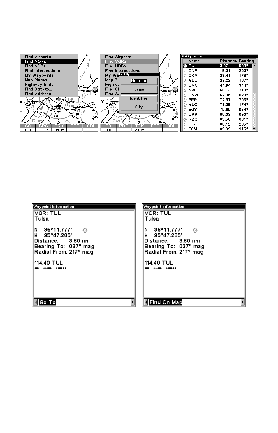
3. AirMap says it is calculating, then a list of VORs appears, with the
closest at the top of the list, and the farthest at the bottom of the list.
The nearest is highlighted.
Find VORs Menu, left; Search Criteria menu, center; and
list of the nearest VORs, right.
4. If you wish, you could scroll
↑ or ↓ here to select another VOR, but
for now we will just accept the nearest one. Press
ENT
.
5. The waypoint information screen appears. If you wanted to navigate
there, you press
ENT
, since the
G
O
T
O
command is highlighted. But we
just want to see it on the map, so press
→ to
F
IND
O
N
M
AP
|
ENT
.
Waypoint information screen on VOR nearest this position. Screen
shows name, identifier, city, radio frequency, latitude/longitude and its
compass bearing. It also shows both distance to the VOR and your "Ra-
dial From" – information ready at your fingertips when Air Traffic Con-
trol wants a position report! The figure at left shows Go To command;
right figure shows Find On Map command.
6. AirMap's map appears, with the cross-hair cursor highlighting the
VOR's symbol. A pop-up name box identifies the VOR. A data box at the
bottom of the screen continues to display the location's latitude and
longitude, distance and bearing.