Nearest icons, Overview – Garmin aera 500 User Manual
Page 21
Garmin aera 500 Series Pilot’s Guide
190-01117-02 Rev. A
9
Overview
Overview
GPS Navigation
Flight Planning
Hazar
d
Avoidance
Additional F
eatur
es
Appendices
Index
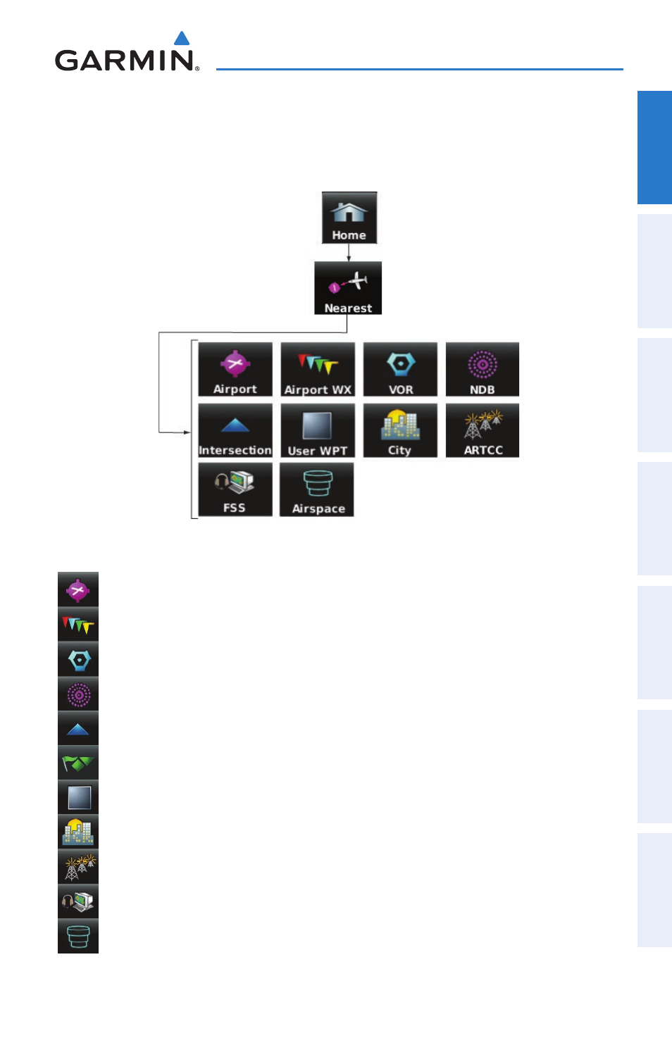
NEAREST ICONS
From the ‘Home‘ Screen, touch the Nearest Icon to access the second-level
Nearest Icons.
Touch the following icons to perform the associated function:
Airport
Displays nearest airports.
Airport WX Displays nearest airport weather.
VOR
Displays nearest VORs.
NdB
Displays nearest NDBs.
Intersection Displays nearest intersections.
VRP
Displays nearest Visual Reporting Point (VRP) (Atlantic).
User WPT
Displays nearest user waypoints.
City
Displays nearest cities.
ARTCC
Displays nearest ARTCCs.
FSS
Displays nearest Flight Service Stations (FSS).
Airspace
Displays nearest airspace.