Proximity waypoints, Appendix g – Garmin aera 500 User Manual
Page 177
Garmin aera 500 Series Pilot’s Guide
190-01117-02 Rev. A
appendix G
165
Overview
GPS Navigation
Flight Planning
Hazar
d
Avoidance
Additional F
eatur
es
Appendices
Index
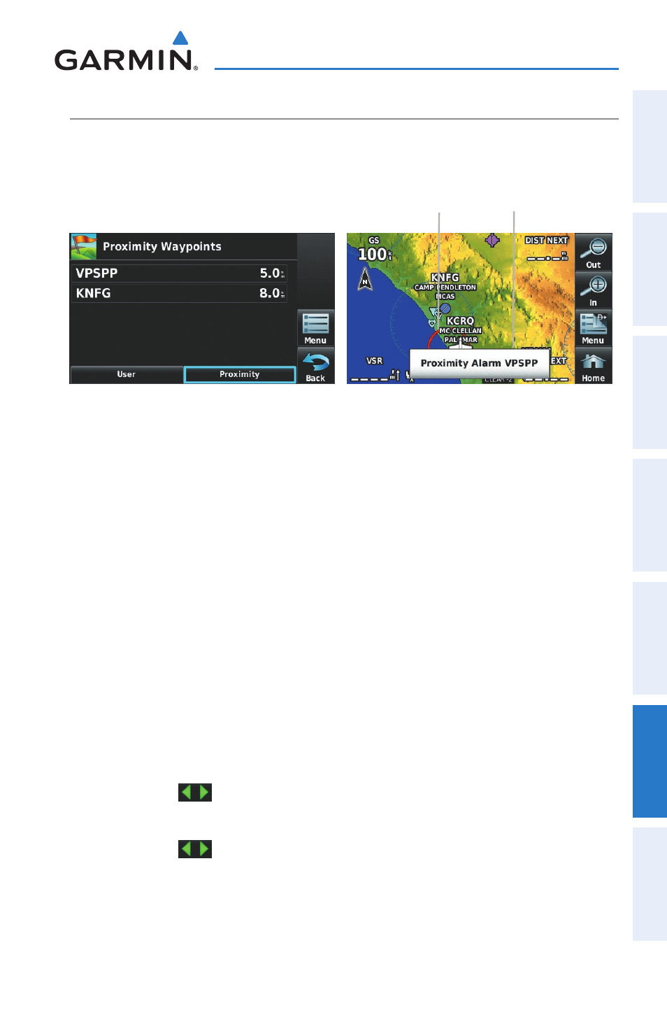
PrOxiMity wayPOiNtS
The Proximity Waypoints allows the pilot to define an alarm circle around a waypoint
location.
Proximity Waypoints
Proximity
Circle
Proximity
Alarm
defining proximity waypoints:
1) From the 'Home' Screen, touch Tools > User WPT > Proximity > menu
> New Proximity Waypoint.
2) Touch 'Use Identifier' or 'Use map'.
3) Enter the desired identifier or pan the map.
4) Touch the newly created Proximity Waypoint, and touch 'Edit Radius'.
5) Enter the desired Radius and touch OK.
Setting up and customizing proximity waypoints for the naviga-
tion map:
From the 'Home' Screen, touch Tools > User WPT > Proximity > menu
> Enable/disable Proximity Alarms.
Or:
1) From the 'Home' Screen, touch map > menu > Set Up map.
2) Touch the
buttons to display the 'Point' Category.
3) Touch Proximity Circle.
4) Touch the
buttons to select the desired settings ('Off', 'Auto', or
Range Settings).