Markers and controls displayed on maps, Screens during route setting – Subaru 2012 Tribeca Navigation System User Manual
Page 14

13
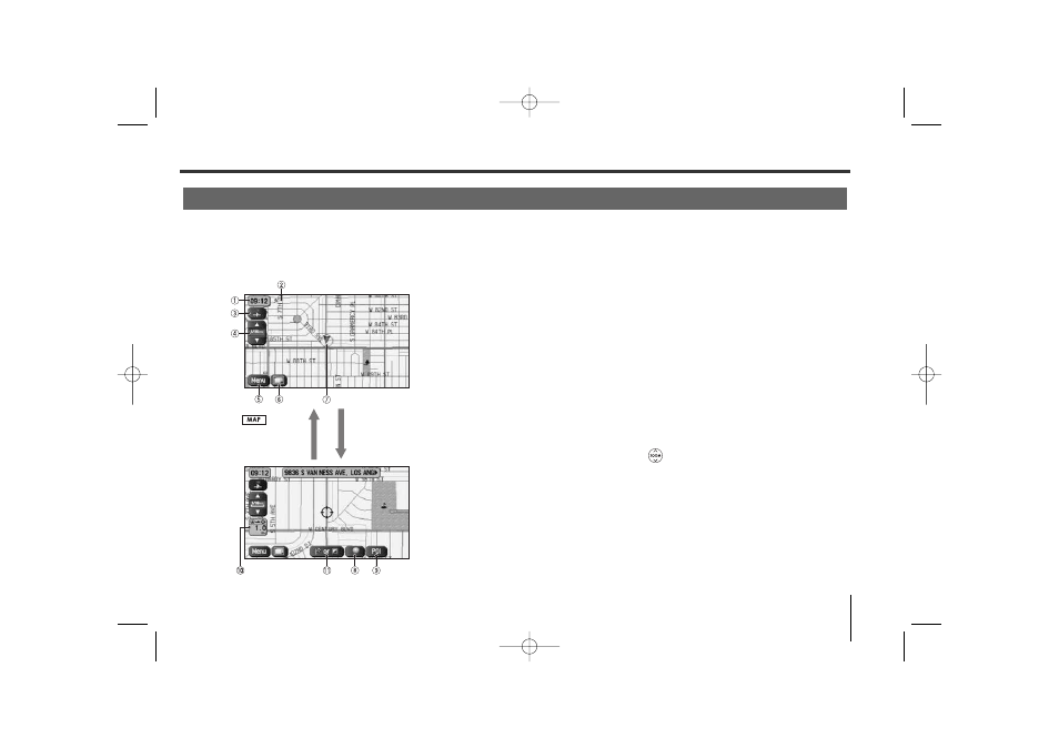
Markers and Controls Displayed on Maps
Touch a point on the map. A crosshair (scroll mark) will appear on the screen. Then touch a desired point on
the map. The map will scroll with the selected point at the center.
Screens During Route Setting
Scroll the map
Press button
to return to the
current map screen.
1 Time
Indicates the current time.
2 GPS marker
Shows the status of the signal from GPS satellites.
When this marker appears, your navigation system is
receiving GPS signals and using them to calculate the
position of your vehicle.
3 Map orientation control
Used to select either a “north up” display or “heading up”
display of the map. (See Page 18.)
4 Zoom-out/zoom-in control and map scale
The up-pointing or down-pointing arrow is used to zoom out
or zoom in the map. The number indicates the scale of the
displayed map. The
button also provides the zooming
function.
5 Menu control
Select this key to display the menu screen. (See Page 16.)
6 Screen configuration control
Allows you to select a preferred display type for route
guidance. (See Page 47.)
7 Vehicle marker
Indicates the current position and direction of your vehicle.
TribecaNavi_US_B3112BE.qxd 06.12.12 11:08 AM Page 13
