Gps simulator – Eagle Electronics 502C User Manual
Page 81
75
GPS Simulator
The GPS simulator lets you use the unit as if you were outdoors navi-
gating somewhere. It's a great way to practice using your unit. You can
set the starting location by entering latitude/longitude (Starting Posi-
tion) or from a stored waypoint, map place or POI location (
C
HOOSE
S
TART
command). You can steer your position and change speed on the map by
using the arrow keys (
S
TEER WITH
A
RROWS
command) or by setting the track
and speed in the dialog boxes provided on the simulator menu screen.
To get to the GPS Simulator:
1. Press
MENU
|
MENU
|
↓ to
GPS S
ETUP
|
ENT
.
2. Press
↓ to
GPS S
IMULATOR
|
ENT
. The GPS Simulator Menu appears.
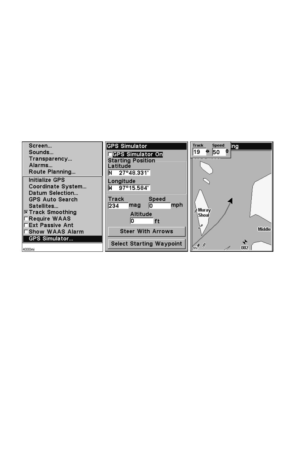
GPS Setup Menu (left) and GPS Simulator menu, center. Map Page
shows Track and Speed steering arrow indicators, right. In this exam-
ple, you are "traveling" across Mudisland Point on a track of 19º
at a speed of 50 miles per hour.
Make the desired settings, then turn the simulator on by highlighting
the
GPS S
IMULATOR
O
N
box and pressing
ENT
key. Press
EXIT
|
EXIT
|
EXIT
to erase this menu. A message and tone appear periodically, warning
you that the simulator is on. To turn the simulator off, repeat the above
steps or turn the unit off.
While in simulator mode, you can press
EXIT
to clear the steering and
speed boxes from the screen while continuing the simulation. This will
allow you to use the map cursor during a simulation. To turn steering
and speed boxes back on again, return to the GPS Simulator menu, se-
lect the
S
TEER WITH
A
RROWS
command, press
ENT
, then Press
EXIT
|
EXIT
|
EXIT
to return to the previous page.