View present position, Show and hide enroute map features, Hide the legend for terrain – Jeppesen FliteDeck Pro (iOS) User Manual
Page 42: View distance calculations
Viewing Enroute Map Information
View Present Position
October 2014
Jeppesen FliteDeck Pro User Guide
Copyright © 2014 Jeppesen. All rights reserved.
35
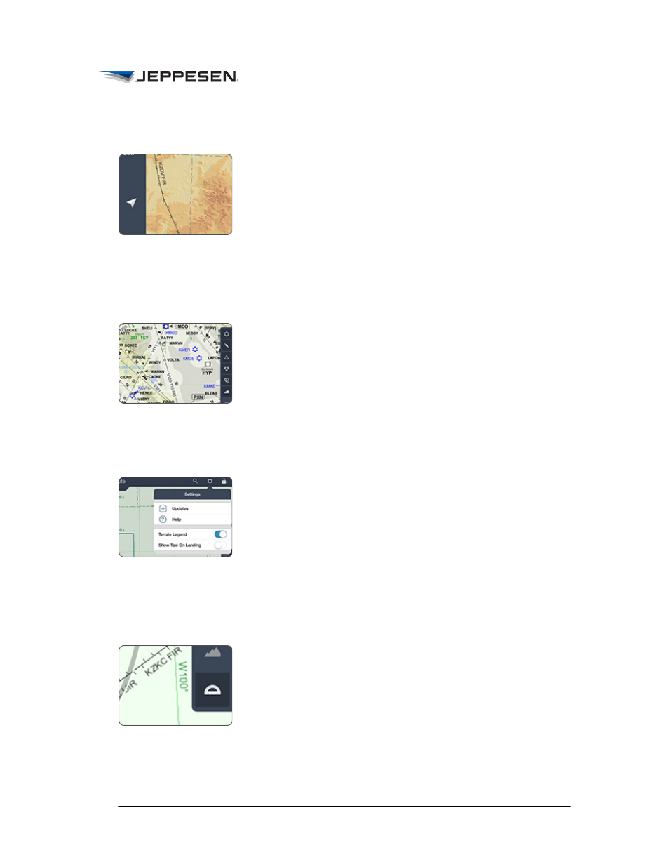
View Present Position
The Present Position button is available in the Enroute view
when the minimum GPS accuracy requirement is met and Enable
Moving Map in JeppFD-Pro global settings is set to ON.
To recenter the map over your aircraft position after you have
panned away, tap the Present Position button.
Show and Hide Enroute Map Features
To toggle between showing and hiding airports, airways,
waypoints, navaids, airspace, and terrain on the enroute map, tap
any of the filter buttons on the right side of the Enroute view.
Depending on the zoom level, certain enroute map features are
automatically filtered to declutter the map.
Hide the Legend for Terrain
To hide the terrain legend that appears on the enroute map when
the terrain filter is set to show, tap the Settings button on the
Jeppesen FliteDeck Pro toolbar, and then switch Terrain Legend
to OFF.
View Distance Calculations
The distance-measuring tool is a set of range rings or arcs that
provide awareness of your distance to objects on the map at a
glance.
To show and hide the range rings, tap the Range Rings button.