Garmin GPS 95STD User Manual
Page 34
5-4
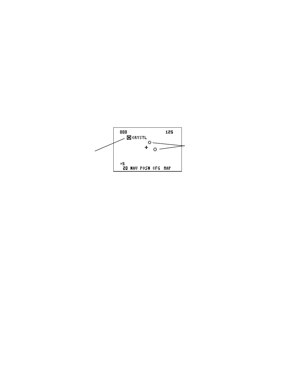
The GPS 95 also features a Map Display which shows a graphic top view of
your location. The current ground speed is indicated at the top right corner
of the display. The top left corner defines the orientation of the Map Display:
“North up”, “Ground track up”, or “Desired track up.” If “000” is shown, the
Map Display is oriented “North up.” (See Section 5.3 for selection of Map
Display orientation.) Your present position is shown in the middle of the
display. If the Map Display is oriented “Ground track up” your present
position is indicated by an aircraft symbol. If either “North up” or “Desired
track up” orientations are selected, the present position is indicated by a
crosshair (“+”).
You may select which items you wish to display. The Map Display can
provide up to nine nearest waypoints. GOTO or route waypoints which are
not part of the nine nearest waypoints will also be displayed. The track history
and/or the active route may also be shown as solid lines on the display.
Selection of which items to display is performed on the Map Configuration
Page. (See Section 5.3.)
You may view the identifier for any waypoint on the Map Display by moving
the cursor over that waypoint (with the arrow keys). By moving the cursor
around the page you can identify each waypoint shown. Keep in mind that
when the cursor is over a waypoint identifier you may review information
about that waypoint by pressing ENT, or plot a course to that waypoint by
pressing GOTO.
The scale distance for the screen (distance represented by the height of the
screen) is at the lower left corner of the screen. The scale number (directly
above the scale distance) may be changed to the level that you desire. You
may zoom in to a .5 nautical mile scale, or out to a maximum scale of 240
nautical miles.
Waypoint highlighted
(w/identifier)
Waypoints