Operation flow chart – Furuno BACK GP-80 User Manual
Page 12
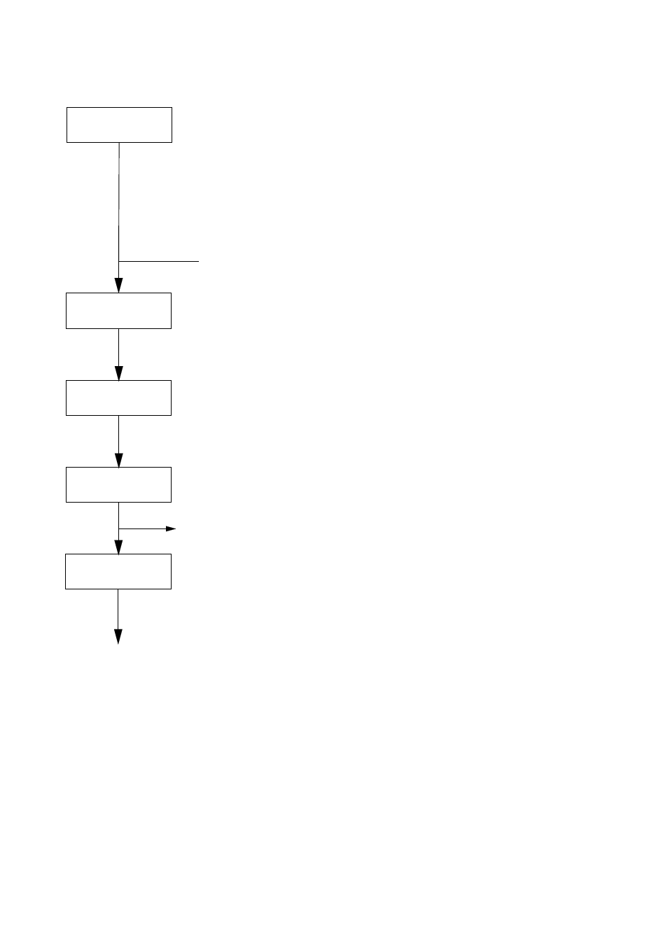
4
• Plotter 1 (own ship's track and data)
• Plotter 2 (own ship's track)
• Highway (ship's track overlaid on
navigation lane)
• Navigation (graphic navigation data
display for steering)
• Data (alphanumeric navigation data)
Select display
mode
Set destination temporarily
Set
destination
Display steering data
• By latitude and longitude
• By LOP
Register
waypoints
Register
routes
Set alarms
Perform other operations as required.
(Position correction, geodetic chart to use,
enter smoothing, calculate range and
bearing to a point, etc.)
3. Operation Flow Chart
See also other documents in the category Furuno GPS receiver:
- MARINE RADAR 1953C (100 pages)
- GP-1650D (2 pages)
- GP-1650WD (96 pages)
- GP-1650W (96 pages)
- NAVNET 1943C-BB (92 pages)
- GD-3300 (137 pages)
- DUAL GPS GP-150-DUAL (130 pages)
- GP-1650WF (113 pages)
- CH-300 (124 pages)
- NX-300 (65 pages)
- NX-300 (2 pages)
- GP-1850WDF (115 pages)
- GP-3500 (192 pages)
- GP-1850WD (44 pages)
- GP-1850W (98 pages)
- GP-1850WD (98 pages)
- GP-1850W (4 pages)
- GP-1850W (98 pages)
- INTERFACE UNIT IF-2500 (12 pages)
- GP-31 (2 pages)
- GP-33 (98 pages)
- GP-7000 (28 pages)
- GP-7000 (2 pages)
- GP37 (2 pages)
- GP-90 (36 pages)
- CI-35 (69 pages)
- GP-1850DF (63 pages)
- GP-1850F (110 pages)
- GP-30 (2 pages)
- FCV-30 (110 pages)
- LC-90 MARK-II (2 pages)
- GP-1650W (44 pages)
- DD-80 (119 pages)
- RP-250 (73 pages)
- GP-1650 (94 pages)
- GP-185F (4 pages)
- GP-1600F (97 pages)
- GP-1850D (94 pages)
- GP-7000F (132 pages)
- GP-7000F (52 pages)
- GP-36 (81 pages)
- GP-150-DUAL (123 pages)
- GP-80 (37 pages)
- 1650WDF (4 pages)